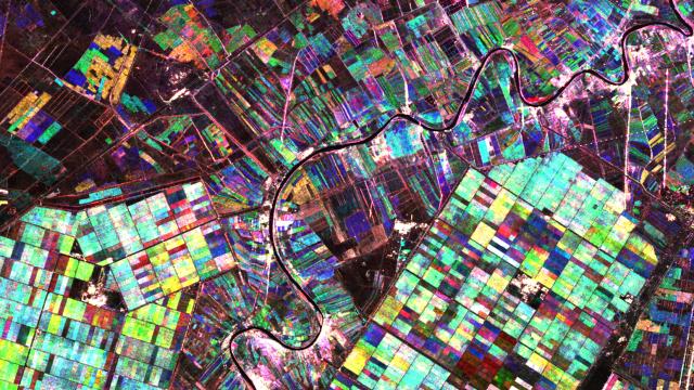
If this image looks oddly familiar, it’s because its a series of crop fields seen from the air — just as a wonderful, colourful radar composite image.
The images that were used to make the picture were captured by Japan’s ALOS satellite. The different colours show changes in the fields between image acquisitions — like harvesting at different points through the year. ESA explains what you can see:
The most prominent fields in this image each measure about 1 km across. To the lower right, the smaller structures are ponds for aquaculture. Important fish for inland fisheries include carp, roach and mullet.
Running through the centre of the image is the Karun River. It is the country’s only navigable river, originating in the Zagros mountains and running its 720 km course southwest and into the Shatt al-Arab river, which then flows into the Persian Gulf.
The few bright white flashes you can see are reflections from big, solid human-made structures like buildings and power line towers. [ESA]