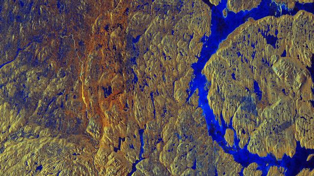
Image Cache: This isn’t the surface of another planet. In fact, it’s a flase-colour image of Canada’s Manicouagan Crater, as captured by the European Space Agency’s Sentinel-1A satellite.
Created over 214 million years ago, the crater — which you can see clearly on the right of the image — is one of the oldest and largest impact craters on the planet, measuring 100km across. The image was captured by Sentinel-1A’s radar sensing equipment, and the different colours reveal variations in land cover: blue areas are particularly wet or icy, while yellow and orange regions are covered by ageing vegetation (fresh vegetation would usually show up in red).
[ESA]