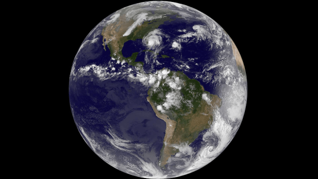
Hurricane Matthew’s deadly rampage across the Caribbean and up Florida’s coast has kept satellite operators completely engrossed over the past week, as they rush to process more and more jaw-dropping images of our waking meteorological nightmare.
Image: NASA Goddard Instagram/NASA-NOAA GOES Project
We’ve collected a few of Matthew’s best photos here, in semi-chronological order (dates and times are local). This, my friends, is the biography of a monster.
28 September 2016: Matthew sputtered to life as a puny tropical storm just east of the Lesser Antilles. Little did anyone know what it would soon be capable of.
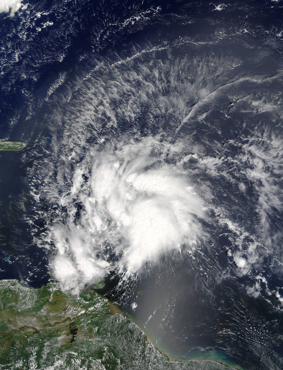
Image: NASA Goddard MODIS Rapid Response Team
30 September 2016: Very suddenly, Matthew strengthened into a major, Category 3 hurricane. Meteorologists started paying attention.
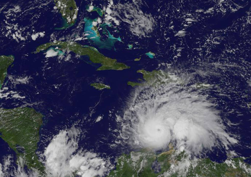
Image: NASA/NOAA GOES Project
30 September 2016… later: Matthew’s rapid rise to Category 3 status was just the beginning. It continued to gain strength on the evening of the 30th, stunning meteorologists as it approached Category 5 status around midnight. It became one of the three most rapidly intensifying storms in Atlantic hurricane history.
#Matthew ends a 3314 day drought since the last Category 5 hurricane in the Atlantic (Felix-2007). pic.twitter.com/dzfa3OC5T8
— Philip Klotzbach (@philklotzbach) October 1, 2016
#Matthew rapidly intensifying into a Category 5 hurricane today. https://t.co/2wUgCVIBds pic.twitter.com/chSKHmj3ud
— Ian Livingston (@islivingston) October 1, 2016
3 October 2016: Matthew cooled off a bit over the weekend, dialling back to a Category 4 as it started to take aim for Haiti. Here it is looking organised and battle-ready just 354km southeast of Kingston.
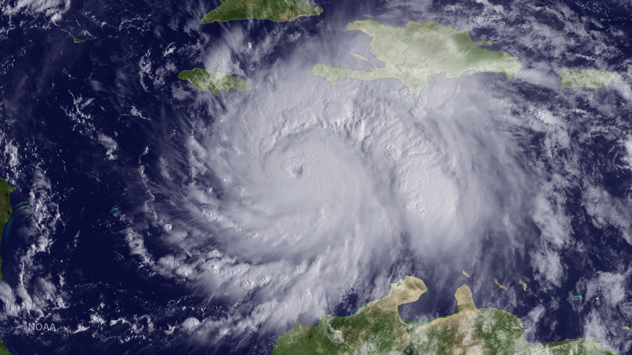
Image: NOAA
2-4 October 2016: NASA watched closely as Matthew rumbled toward Haiti over the course of several days. A menacing time lapse turns the storm’s relatively slow, northward march into a furious Caribbean invasion.
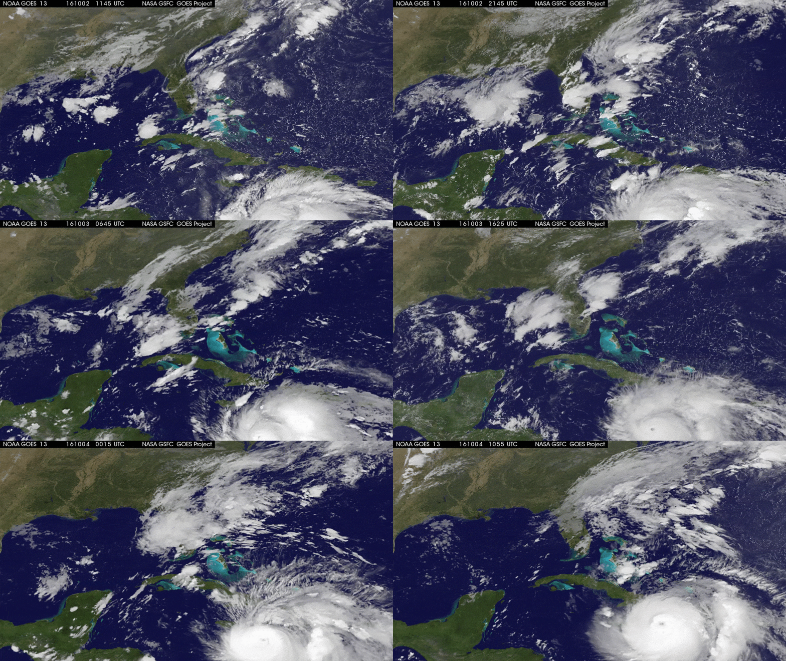
Image: NASA/NOAA GOES Project
4 October 2016: Hurricane Matthew unleashed Category 4 fury as it made landfall over Haiti; 225km/h winds flattened tens of thousands of homes. It’s still unclear just how bad the damage is, but suffice to say this is the nation’s worst humanitarian crisis since the 2010 earthquake.
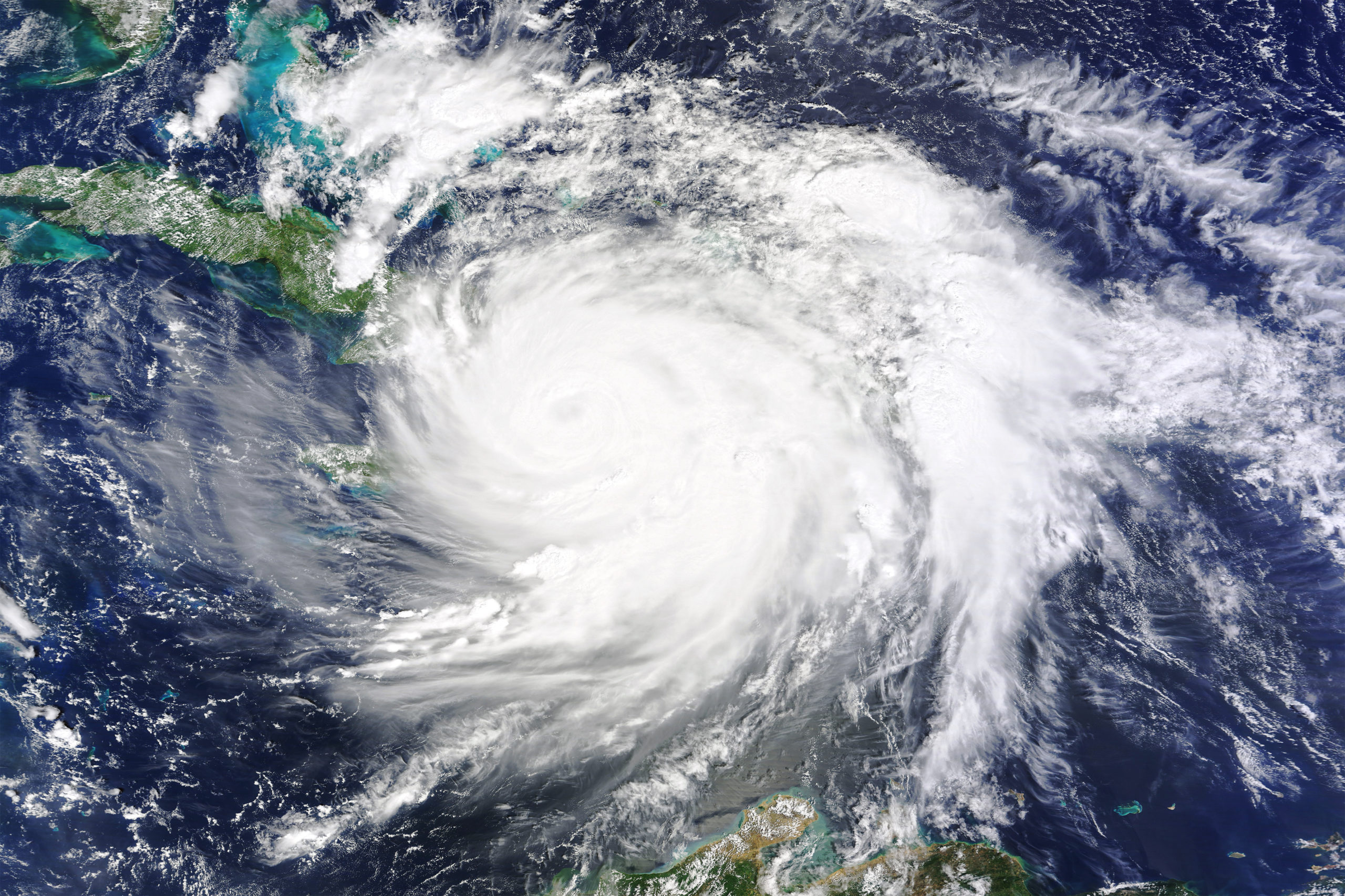
Image: NASA Earth Observatory
5 October 2016: After losing a little of its edge during its trek over mountainous Haiti and eastern Cuba, Matthew barrelled on toward the Bahamas, still large enough to pose a serious threat.
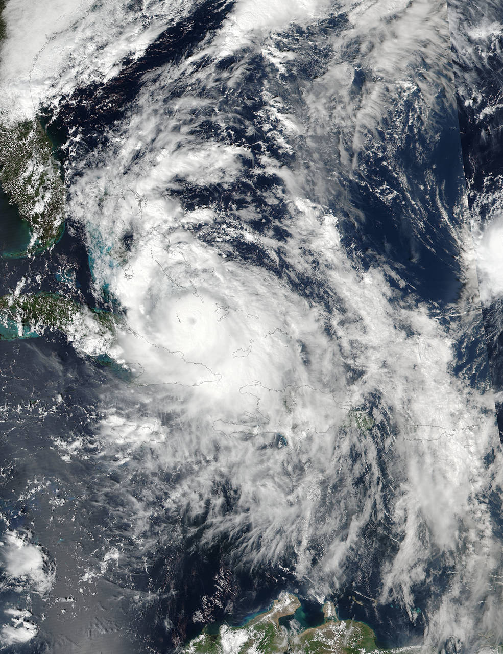
Image: NOAA/NASA Goddard Rapid Response Team
5-6 October 2016: Regaining some of its lost strength as it crossed over the record-warm Bahamas, Matthew spiralled toward Florida’s coast as a deadly Category 4. More than two million people were told to evacuate.
This time-lapse animation was built from images of the storm taken every 30 minutes, from the morning of October 5 through the morning of October 6.
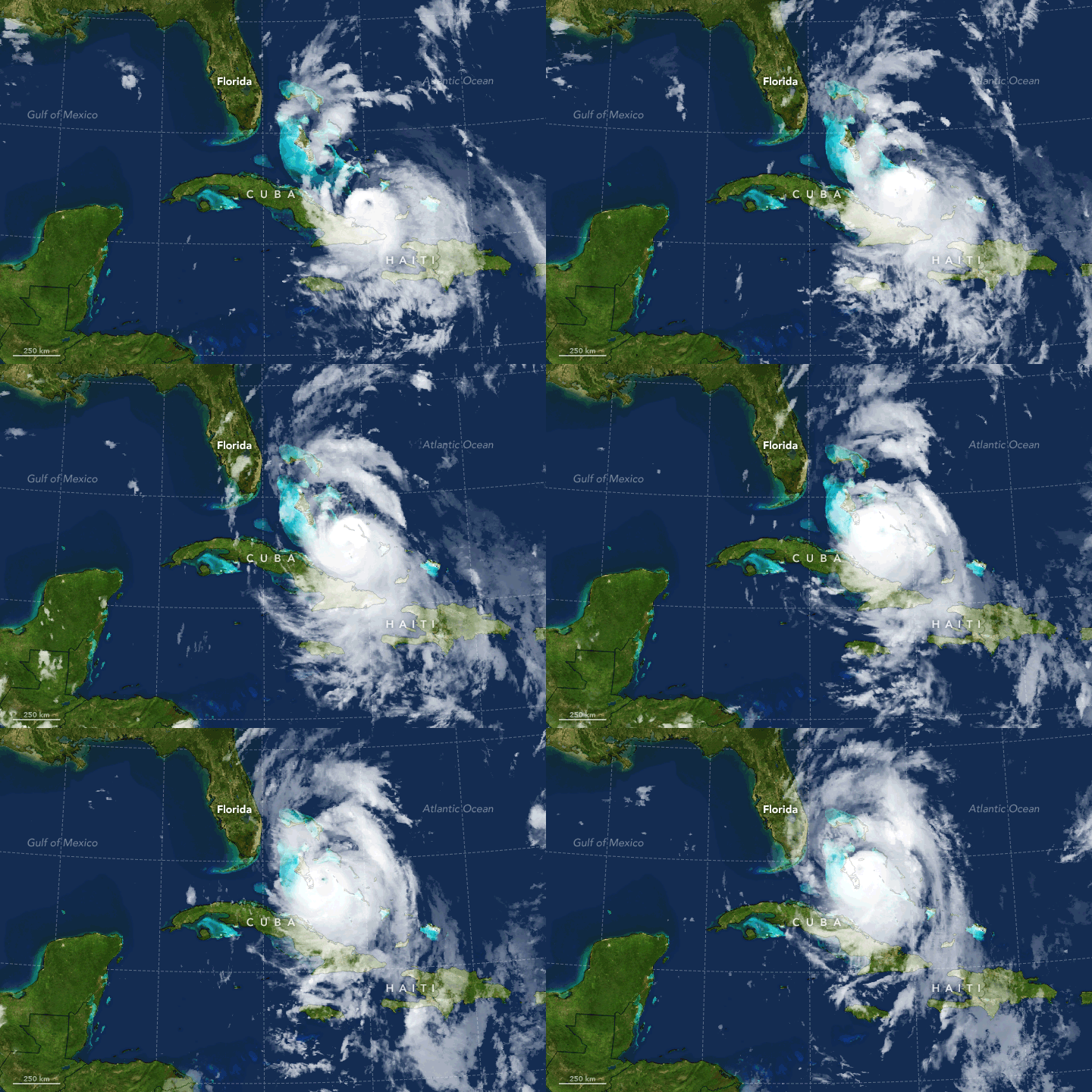
Image: NASA Earth Observatory
7 October 2016: As Hurricane Matthew veered up Florida’s coast today (and was mercifully downgraded to a Category 3), a new tropical storm, Nicole, was starting to get organised out to the east. According to NASA, the dynamic duo have set a new late-season record for Atlantic storms.
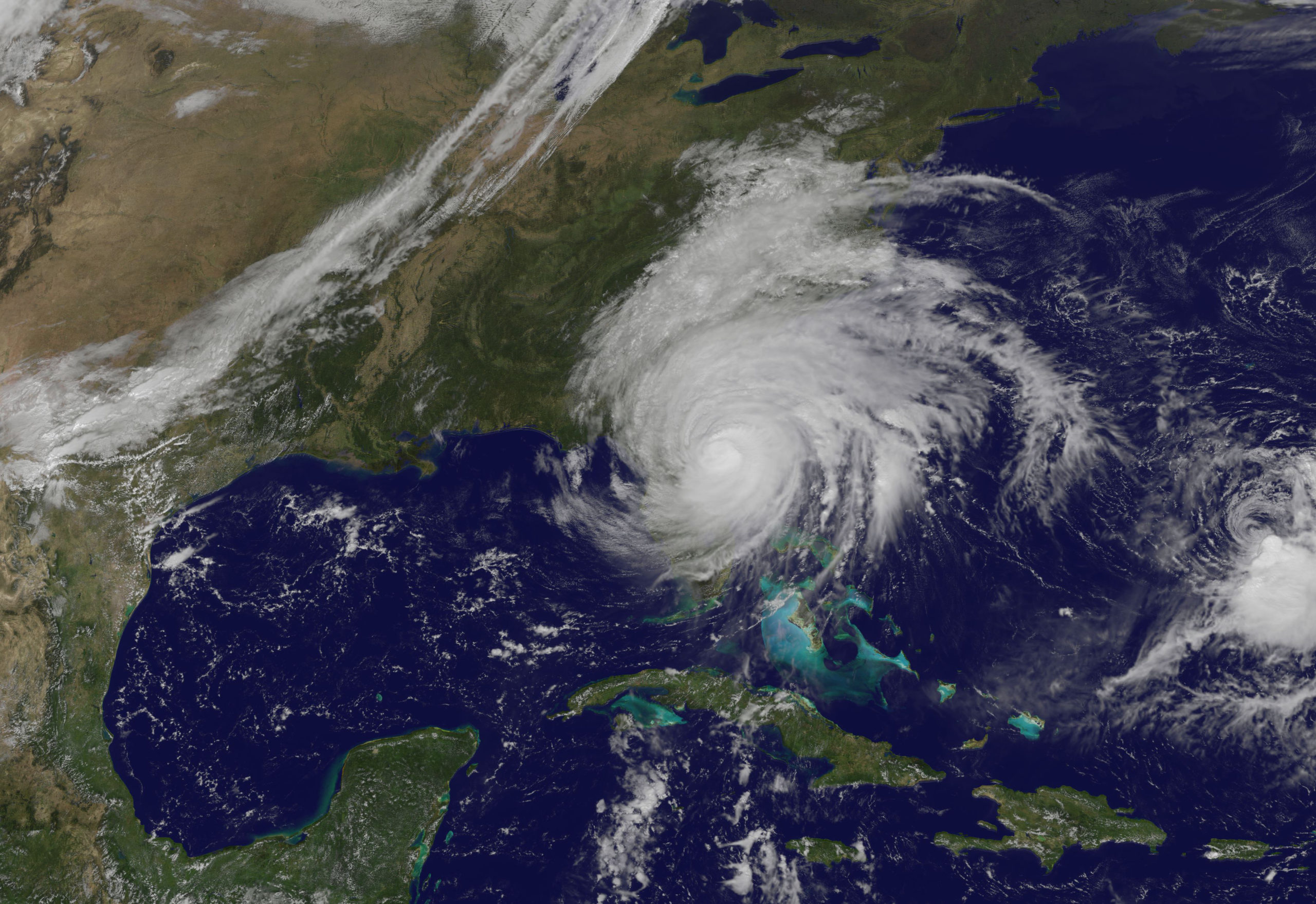
Image: NASA/NOAA GOES Project
7 October 2016: If you really want some perspective on what a leviathan Matthew is, you’ve got to take the long view. Wow.
