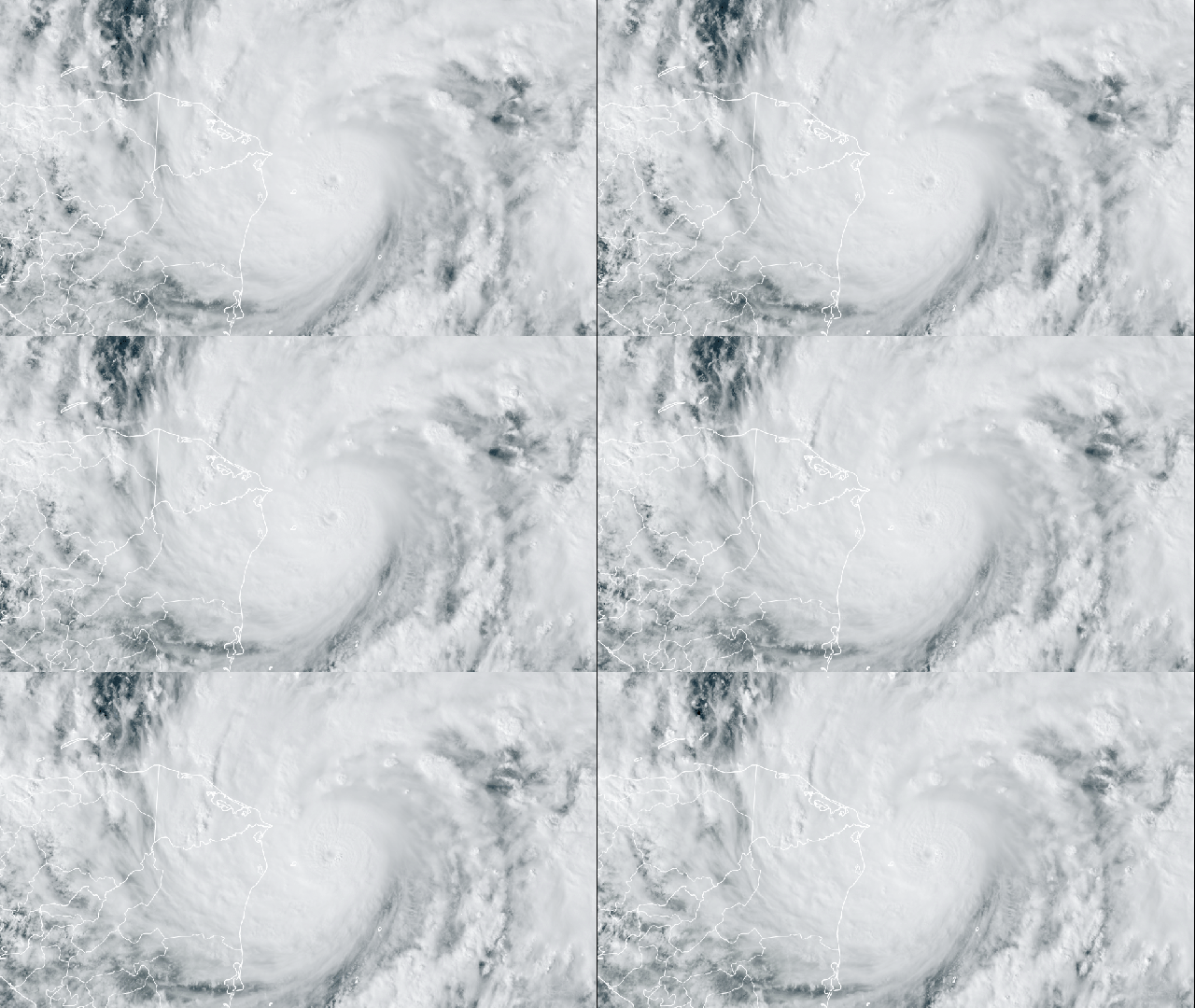
I know there’s a lot going on, but pause for a moment and consider the Caribbean. Hurricane Eta is a monster bearing down on Central America, cranking up from a tropical storm to a major hurricane in 24 hours. Nicaragua — where it’s expected to make landfall — faces “catastrophic” conditions, as do the surrounding countries that will be enveloped in Eta’s heavy rain, powerful winds, and destructive storm surge.
In a hurricane season that has set all sorts of records, Eta unfortunately fits right in. It ties the record for most named storms in a season, setting 2020 up to break a record set in 2005. The cyclone was a barely a tropical storm 36 hours ago, with winds of 64 km/h. By Monday afternoon, though, it exploded into a Category 4 beast, with winds of 209 km/h, and it could strengthen even further ahead of landfall on Tuesday. Rapid intensification is a technical term for when storms see a 56 km/h increase in wind speed over 24 hours. Eta smashed that definition out of the park and is the second-fastest wind speed ramp up on record, trailing only Hurricane Delta from earlier this year.
This is absolutely bonkers behaviour for a storm in November, a time when hurricane season is winding down and storms that do form struggle to rapidly intensify due to cooler ocean temperatures. If it were far out to sea, we could all marvel at Hurricane Eta as a meteorological wonder. Sadly, that isn’t the case.
Eta is set to strengthen while on a collision course with Nicaragua. The country has declared a red alert for areas along the coast and immediately inland. The National Hurricane Centre is calling for “catastrophic” conditions. Along the coast, storm surge could be essentially unsurvivable, with water heights reaching up 5.5 metres above ground. Wherever Hurricane Eta makes landfall will also face destructive winds, as the most intense gusts hover around the eye wall of the storm. But areas more than 161 km away will also face tropical storm-force winds.
The storm is also expected to bring copious amounts of rain. The NHC is calling for 38 to 64 centimetres of rain for most of Nicaragua and Honduras, with significant rainfall across other parts of Central America as it turns northward once over land. That could unleash flash floods and landslides that will make an already-challenging rescue and cleanup operation even more difficult.
Eta’s rapid intensification before landfall fits the pattern of few other storms this year. Notably, hurricanes Hanna, Laura, and Zeta all did a similar ramp-up 24 to 48 hours before landfall. In the North Pacific, research indicates climate change is to blame for a growing number of storms intensifying prior to landfall. While there are some findings that suggest the Atlantic is seeing more rapidly intensifying storms due to climate change and that storms are growing stronger more quickly, this year’s spate of storms doing it right before landfall is particularly egregious. It might not be the fault of climate change, though.
“Did these storms get some kind of boost from nearby land, or were they just going about their business and land happened to get in their way at the worst possible time?” Brian McNoldy, a hurricane expert at the University of Miami, said in an email. “I think it’s more the latter, and bad luck is the culprit.”
That’s small consolation to those in Eta’s path. Even more unnerving is that storm is expected to curve back out over the Caribbean as a tropical depression after plodding over Central America all week. From there, there’s even a chance it powers back up. It’s much too early to worry about that, though, given uncertainty in modelling that far out, especially with Eta posing a very real and present danger right now.
