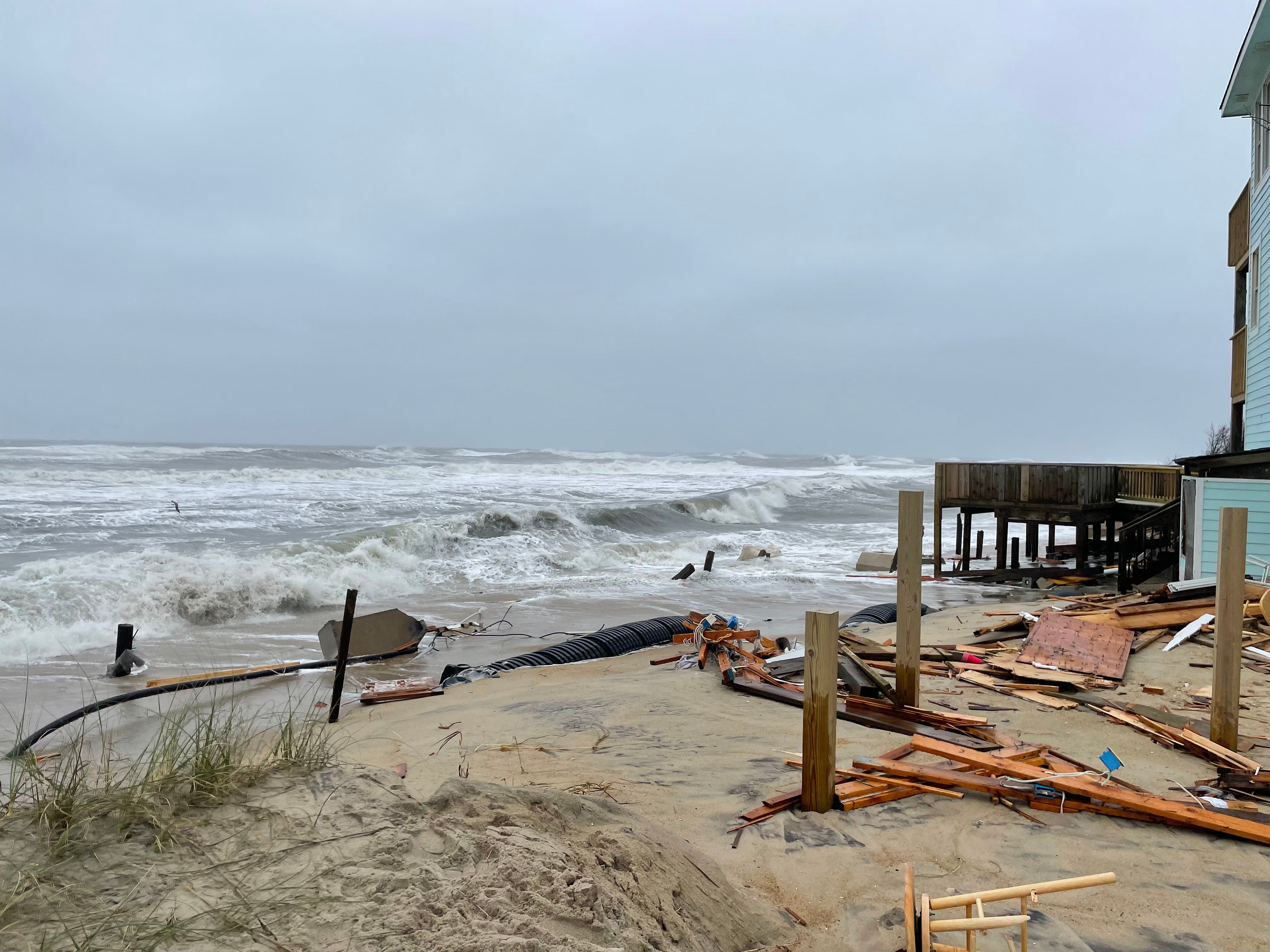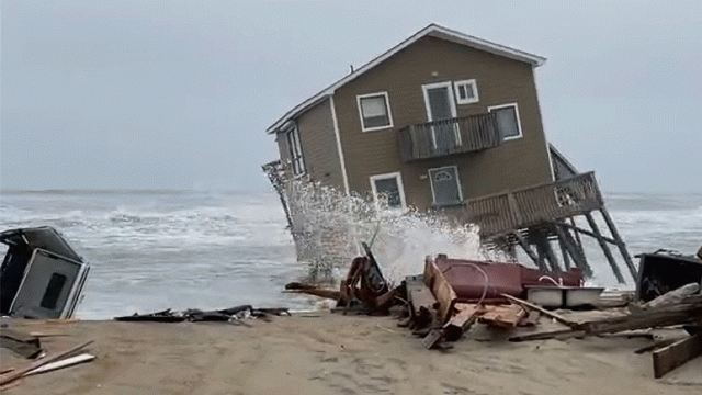
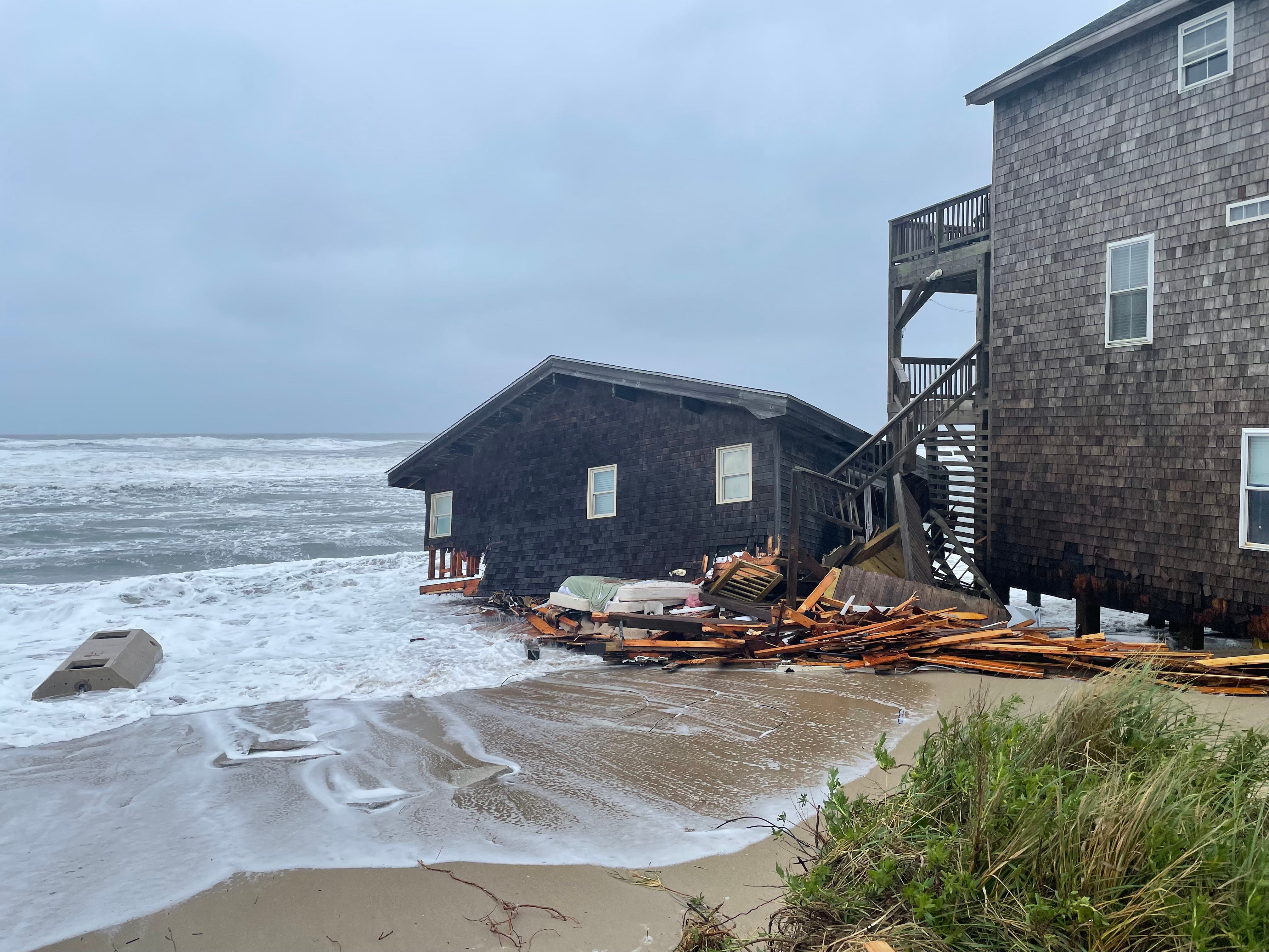
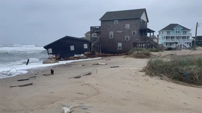
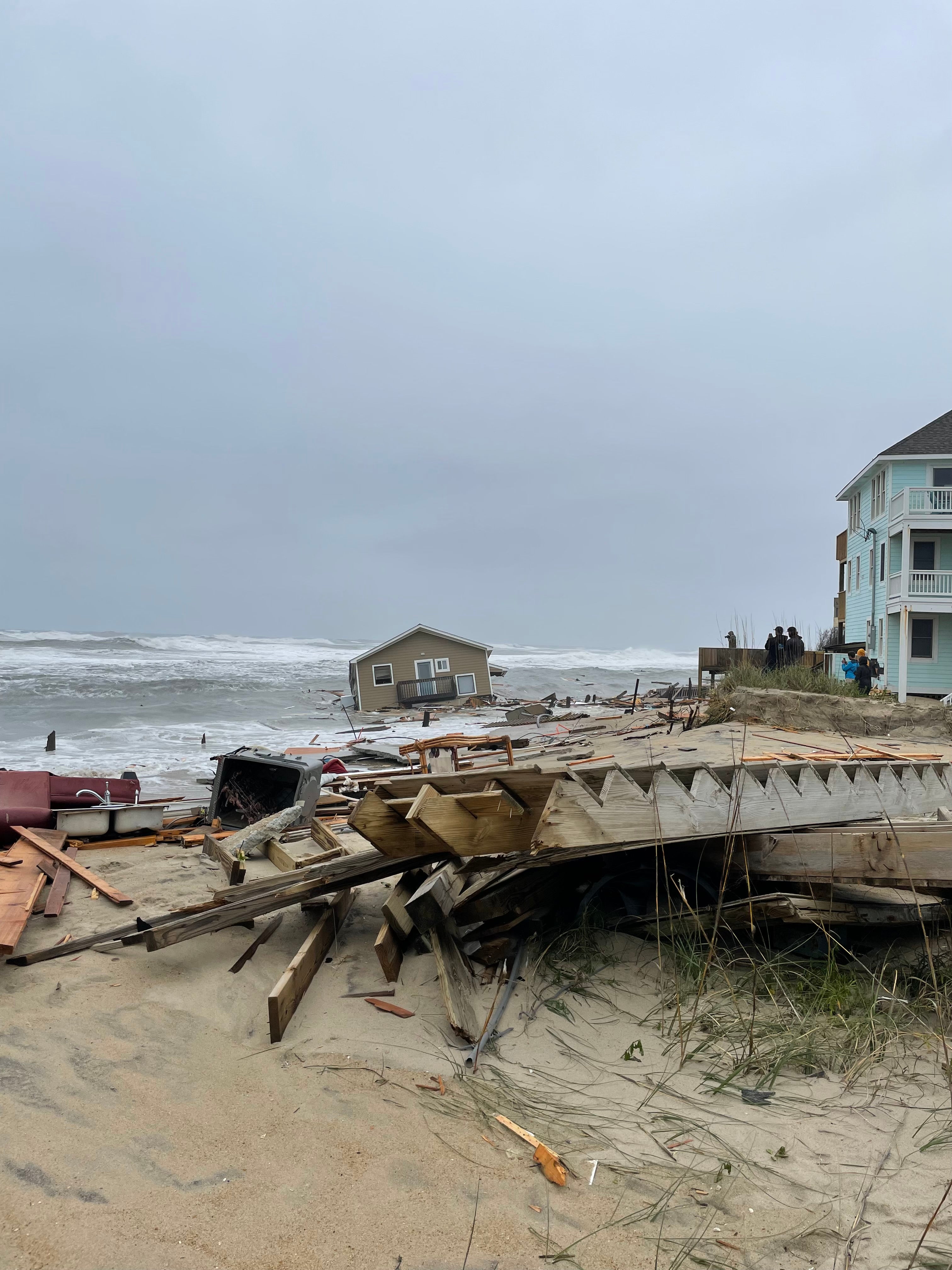
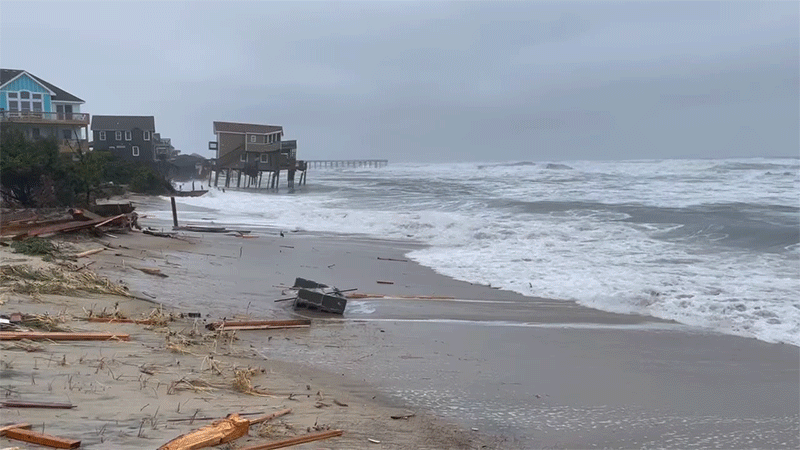
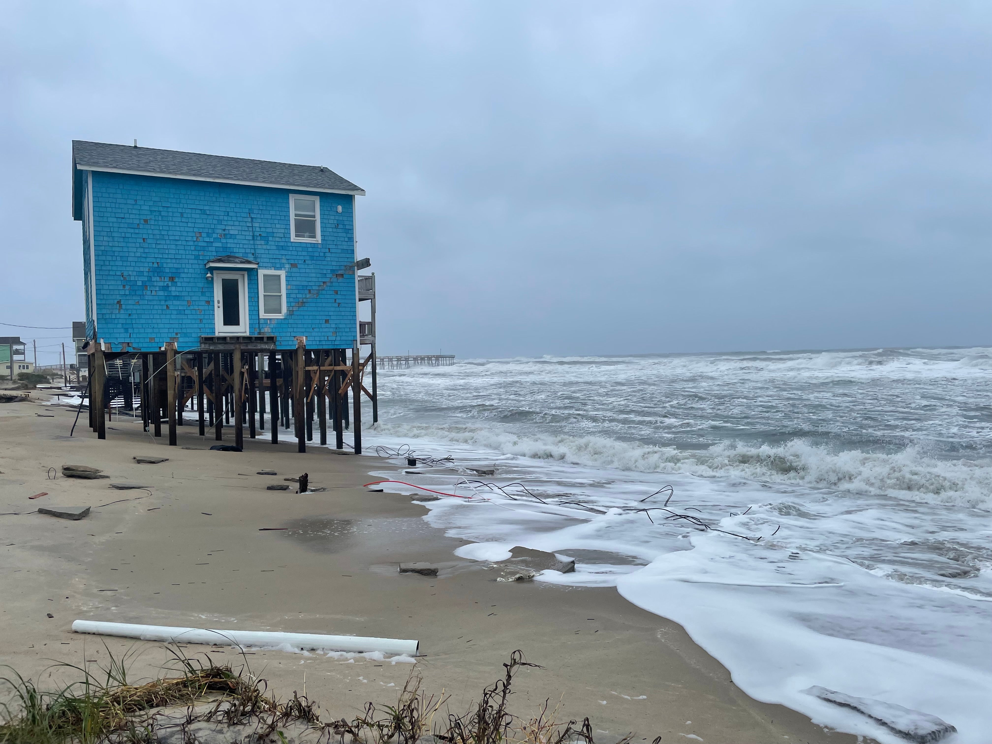
On Tuesday, amid high tides and heavy winds brought on by a storm, two unoccupied houses in the Outer Banks, North Carolina fell into the ocean. One collapsed in the early hours of the morning. The other, which fell in the afternoon, was caught on video. The houses were on the same stretch of beach and both were located on Ocean Drive in Rodanthe, a small unincorporated community. No one was hurt, but the destruction is a stark reminder of the conflict between human infrastructure and rising seas.
Cape Hatteras National Seashore (Seashore) has confirmed that an unoccupied house at 24265 Ocean Drive, Rodanthe, N.C. collapsed this afternoon. This is the second unoccupied house collapse of the day at the Seashore. Read more: https://t.co/ZPUiklQAWA pic.twitter.com/OMoPNCpbzk
— Cape Hatteras National Seashore (@CapeHatterasNPS) May 10, 2022
Barrier islands are inherently unstable, ever changing, and meant to transform with the tides. They buffer coastal regions from storms and provide a natural form of boosted resilience for the mainland. Unfortunately, barrier islands are also considered desirable places to build beach-front rental properties. The problem with that is on full view in the National Park Service’s Flickr account, which features multiple videos and pictures of yesterday’s damage.
This isn’t the first time buildings in the Outer Banks have collapsed with the tides. In February, another house fell in the same area, and the National Park Service warned that 11 other homes were in imminent danger, according to reporting by The Outer Banks Voice. In fact, relocating buildings to avoid collapse as the shoreline shifts is common along the 322 km stretch of barrier islands. In 1999, the National Park Service even moved a historic, 200-foot-tall light house almost 914.40 m to get it away from the water.
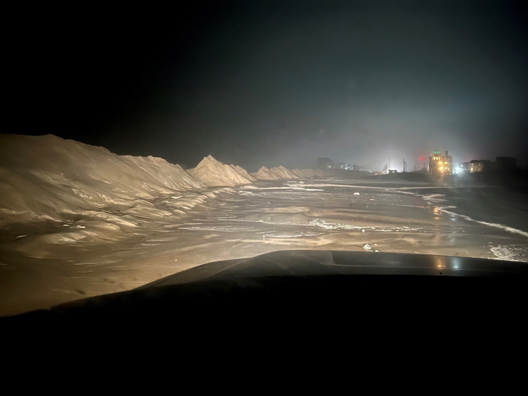
And N.C. Highway 12, which is the only road connecting most of the Outer Banks to the rest of North Carolina, is also a frequent victim of weather and tides bringing washouts, sand, and debris. A long stretch of the highway remains closed as of Wednesday afternoon.
High tides and storms are regular occurrences for the East Coast, especially for changeable and exposed barrier islands. But human-caused climate change is making them worse. Sea level rise along Cape Hatteras National Seashore is consistently increasing more than 5 millimetres each year. Some beaches are losing more than 4.27 m annually through erosion, according to reporting by The New York Times.
The National Park Service estimates that, of all its sites, the Outer Banks is set to experience the most sea level rise. Under the worst-case climate projections, by 2050 storm surges would completely inundate the barrier island system south of the Wright Brothers Memorial. By 2100, NPS estimates, Cape Hatteras National Seashore could experience more than 0.76 m of additional sea level rise, according to a 2018 report. At the same time, hurricanes are dumping more water and becoming stronger, and hurricane season is starting earlier, likely because of climate change.
Then, there’s the issue of human infrastructure exacerbating patterns of erosion. Construction of hard structures likes jetties has been banned in the Outer Banks for decades because, though they can boost protection from the waves for one area, they redirect and increase that land loss elsewhere. But existing buildings and maintaining the islands’ infrastructure still takes a toll.
The Outer Banks isn’t just a vacation destination. More than 35,000 people live on the barrier islands year-round. Among those local communities, controversy over the islands’ management and environmental policies has raged for decades. Building collapses like this exemplify how easily it could all wash away. In the immediate term, though, beaches near the felled houses are closed for clean-up efforts.
The First Fallen House
Video of First House
The Second Collapsed House
House #2 Before Collapse
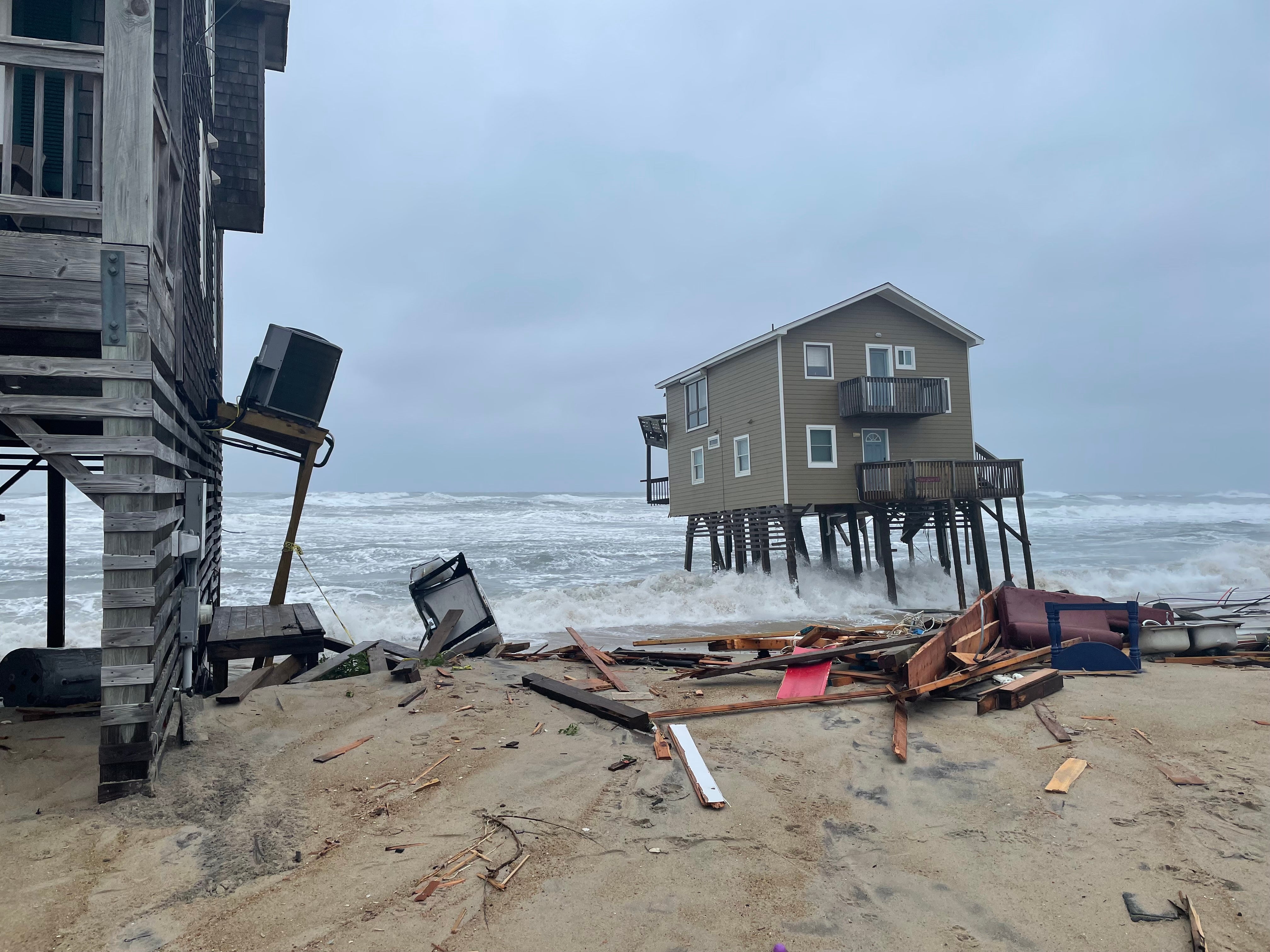
House #2 Leaning Before Collapse
Standing House
High Tides
Debris from Collapse