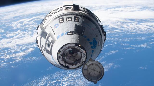
Nearly 140 rockets have flown to space this year, with payloads destined for all sorts of destinations. The vast majority of payloads are deposited into Earth or Earth-related orbits, of which many types exist. Here’s a guide to the various celestial circuits that host human technology, from ones close to home to those a million miles away.
More than 5,500 active satellites are currently working in space, with experts predicting an additional 100,000 by the end of the decade. Each and every one of these satellites requires a specific and predetermined orbit, depending on the task at hand. Sure, it’s a branch of rocket science, but understanding these orbits and how they work is less complicated than you might think.
What does it mean for something to be in orbit?
Before we dive in, let’s do a quick review to appreciate what it actually means for an object to be in orbit.
As Isaac Newton’s famous first law of motion states, an object in motion will stay in motion at a constant speed and travel in the same direction unless acted upon by an unbalanced force. For satellites, that “unbalanced force” is the pull of gravity. An object launched to space would otherwise keep moving in a straight line, but Earth’s gravity pulls it back. The result is a kind of tug-of-war in which an object’s momentum is counteracted by the pull of gravity.
An object’s forward momentum needs to be balanced with the force of gravity; otherwise it won’t stay in orbit. An object moving too slowly will re-enter the atmosphere and fall to Earth, while an object moving too quickly will zoom past our planet. This happy place for satellites, whether natural or artificial, is known as the orbital velocity. For example, a satellite flying 242 kms above Earth requires an orbital velocity of roughly 27,359 km per hour, according to NASA. The higher the orbit, the slower that orbital velocity needs to be.
It’s a misnomer to refer to satellites as “floating” in space. More accurately, objects in orbit are free-falling, but because they’re moving so quickly and in a direction that’s horizontally aligned with the curvature of the Earth, they just keep spinning around and around the planet.
All orbits are elliptical, though some can be nearly circular. The planets orbit the Sun in near-circular orbits, while comets coming in from the Kuiper Belt are caught in highly elliptical orbits. These same rules apply to artificial satellites, though on a much smaller scale.
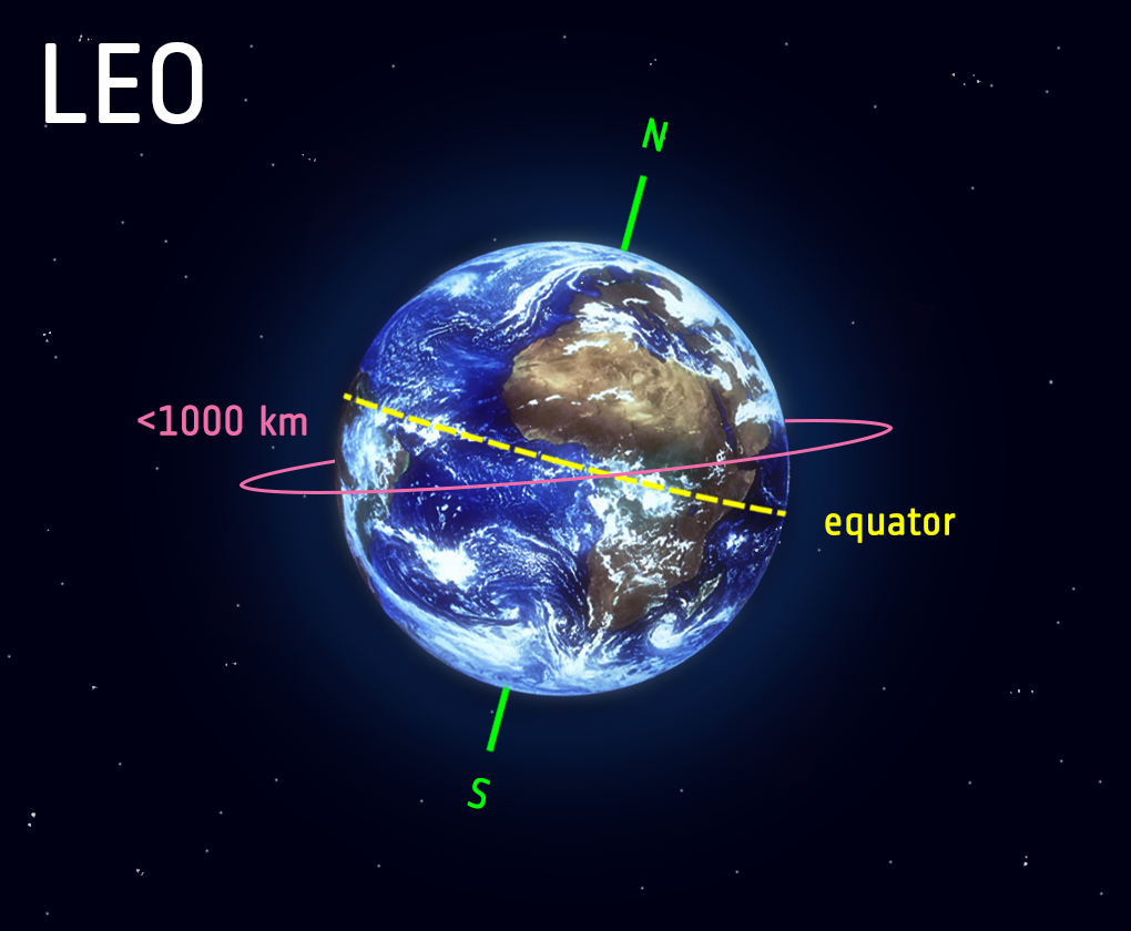
Low Earth orbit (LEO)

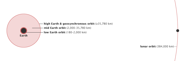
The place we call space officially starts about 60 miles (100 kilometers) above the surface, a delineation known as the Kármán line. But that’s not a feasible altitude for orbit, owing to atmospheric drag. To reach orbit, an object must ascend to altitudes starting at around 100 miles (160 km) above the surface. This is the lowest possible boundary of low Earth orbit, or LEO, which extends to a maximum altitude of about 1,200 miles (2,000 km), NASA says.
Satellites must maintain an orbital speed of around 8 km per second (7.8 km per second) to remain in low Earth orbit. At this speed, it takes a satellite roughly 90 minutes to complete a full circle of Earth. The Hubble Space Telescope, which orbits in LEO at an altitude of approximately 332 miles (543 km) and travels at speeds reaching 28,003 km per hour (28,000 km/hr), completes nearly 15 revolutions of Earth each day.
LEO is a workhorse orbit within which the vast majority of our satellites are located. As of April 30, 2022, some 4,700 operational satellites are in LEO, according to the UCS Satellite Database (the true number is now much higher, given the rapid pace at which SpaceX is launching its Starlink satellites). Low Earth orbit is useful because it’s so close, allowing, for example, low-cost launches to space, Earth-observing satellites to take high-resolution images of the surface, low-power amplifiers for data transmission, and quick and easy access to space stations (fun fact: no human has travelled beyond LEO since the Apollo era). What’s more, the plane of low Earth orbits can be tilted, providing many available orbital paths for satellites.
That said, the speed poses a problem for communication and navigation satellites, as it’s challenging for ground stations to track objects whipping around in LEO. Satellite constellations are an effective but costly work-around, as multiple satellites work together to create a virtual net around the planet. Starlink is a good example — a megaconstellation currently consisting of 3,182 operating satellites that provide internet coverage around the world. The Iridium satellite constellation also works from LEO, providing voice and data coverage to satellite phones and other receivers across the globe.
Another downside of LEO is that it’s increasingly home to a lot of space junk, stuff like defunct satellites, spent upper stages, launch adapters, slag particles, copper wires, and even flecks of paint. Frighteningly, large swaths of LEO could eventually become inaccessible if nothing is done to curb the amount of debris in LEO.
Geostationary orbit (GEO)
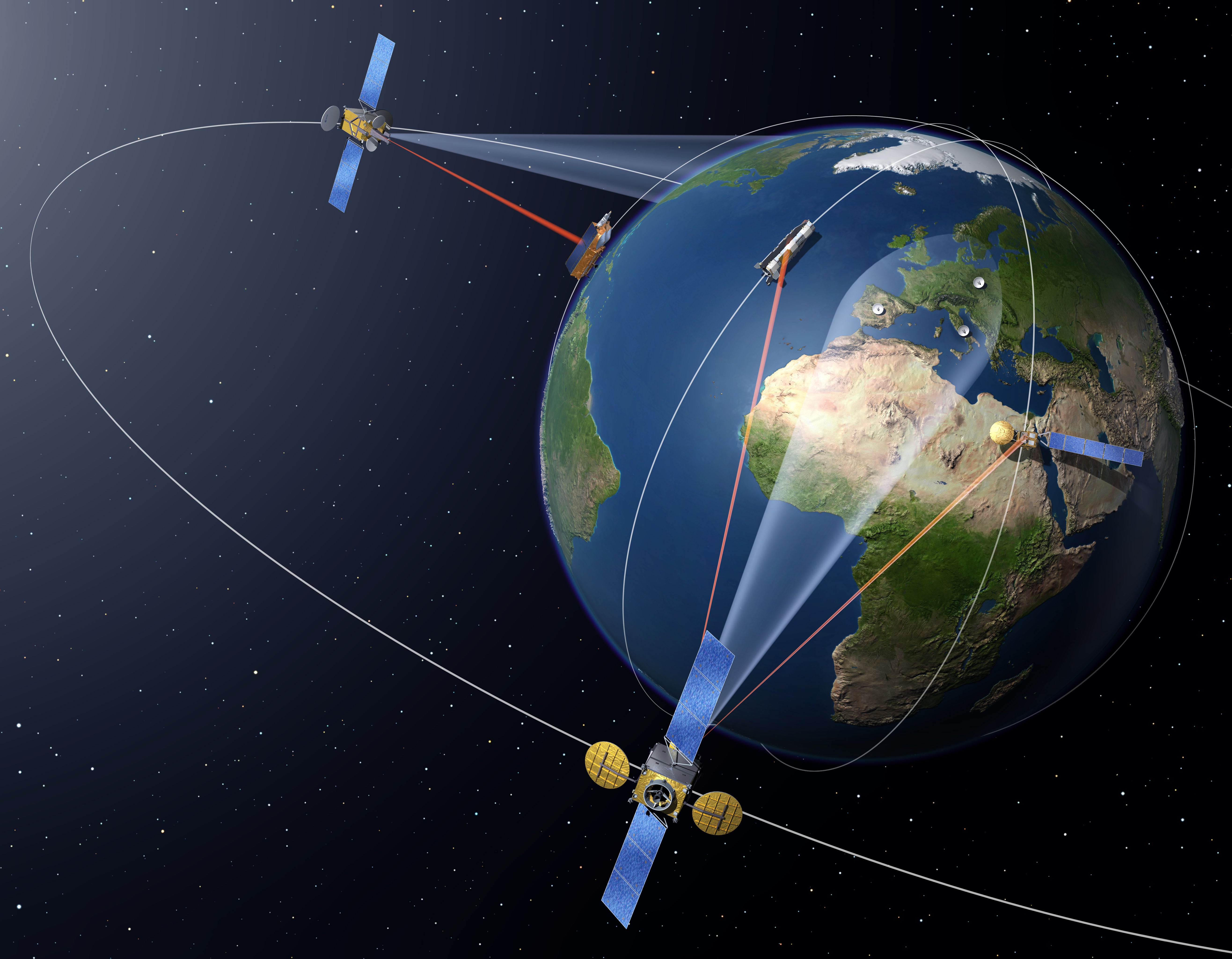
Satellites in LEO zip across the sky, but that’s not the case for objects in geostationary orbit (GEO), also known as geosynchronous orbit. Objects in GEO work directly above Earth’s equator, and their speed matches the rotational speed of Earth. The consequence of this is that satellites in geostationary orbit stay in fixed position relative the surface (fun fact: the orbital location of GEO satellites is known as the Clarke Belt, in honour of sci-fi author Arthur C. Clarke, who conceived of the idea). Satellites in geosynchronous orbits feature an orbital speed of 3 km per second and an orbit that’s roughly 6-times larger than LEO. As “few as three equally-spaced satellites can provide near global coverage,” the European Space Agency says.
A drawback of GEO is that satellites in this orbit work 35,786 km above the surface, which is reasonably far away. That’s one-tenth the distance to the Moon, which amounts to a round-trip delay of 250 milliseconds when transmitting data. At the same time, however, an antenna on Earth’s surface can stay pointed at a satellite in space, which is hugely advantageous.
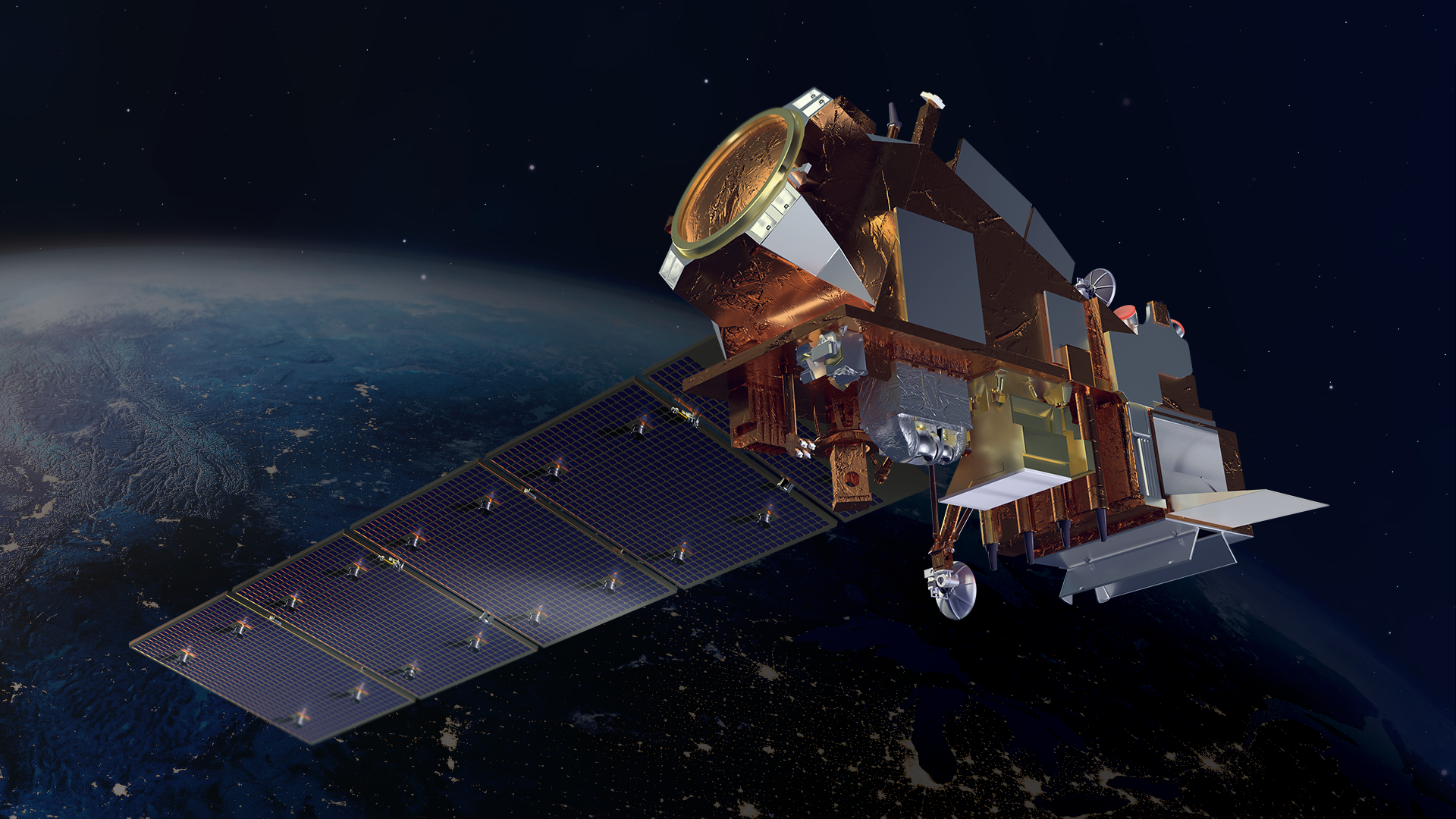
Indeed, GEO is ideal for weather and telecommunications satellites, both of which need to stay above a specific point on the surface. Around 565 operational satellites currently work in GEO, examples being NASA and NOAA’s Geostationary Operational Environmental Satellite-R (GOES-R), an advanced weather satellite, ESA’s European Data Relay System (EDRS), a sophisticated laser communication network, and the John Deere StarFire navigation system, used for agriculture management.
Medium Earth orbit (MEO)
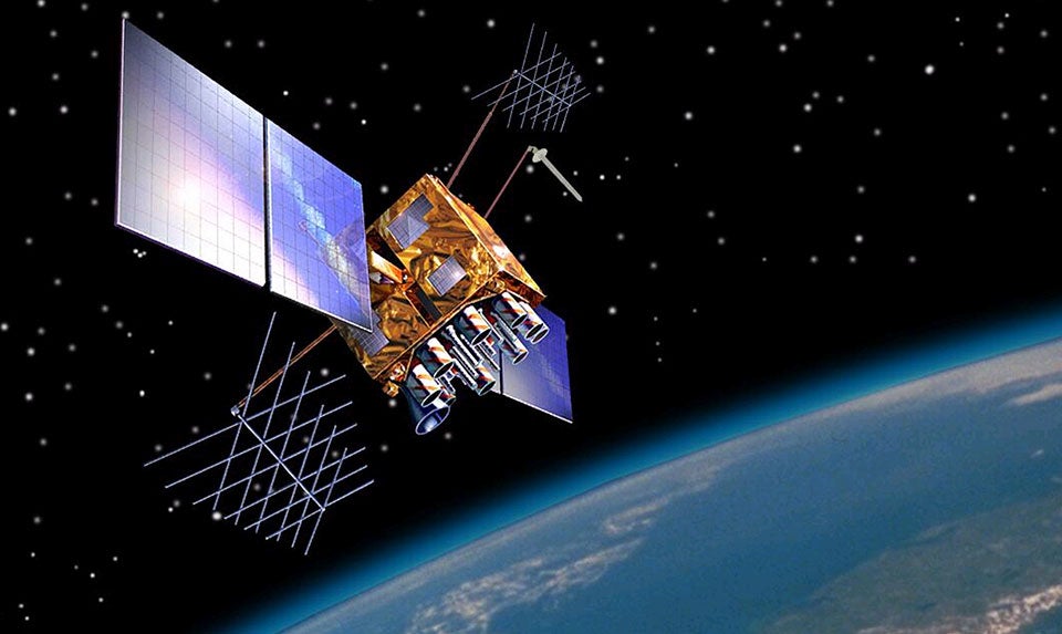
A host of medium Earth orbits (MEO) exist between LEO and GEO, specifically at altitudes between 2,000 and 35,786 km, but most typically between 20,200 and 20,650 km. All objects in MEO feature orbital periods less than 24 hours, which extend down to a minimum of two hours. Medium Earth orbits, currently home to around 140 satellites, are ideal for navigation satellites, which is why Global Positioning System (GPS) satellites are placed there.
There are two main types of MEOs to be aware of, as NASA explains:
The semi-synchronous orbit is a near-circular orbit (low eccentricity) 26,560 kilometers from the centre of the Earth (about 20,200 kilometers above the surface). A satellite at this height takes 12 hours to complete an orbit. As the satellite moves, the Earth rotates underneath it. In 24-hours, the satellite crosses over the same two spots on the equator every day. This orbit is consistent and highly predictable. It is the orbit used by the Global Positioning System (GPS) satellites.
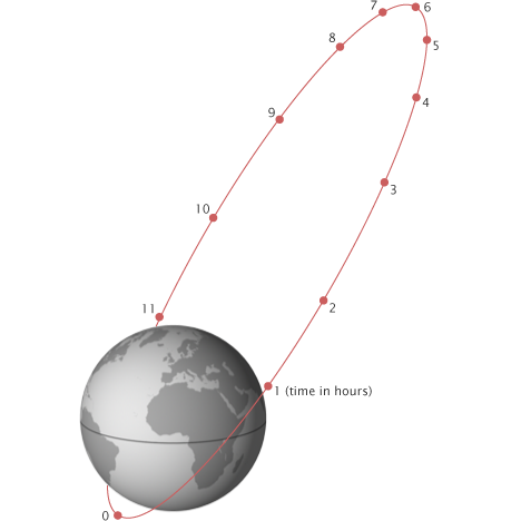
The second common medium Earth orbit is the Molniya orbit. Invented by the Russians, the Molniya orbit works well for observing high latitudes. A geostationary orbit is valuable for the constant view it provides, but satellites in a geostationary orbit are parked over the equator, so they don’t work well for far northern or southern locations, which are always on the edge of view for a geostationary satellite. The Molniya orbit offers a useful alternative.
MEO is useful in the same way that LEO is useful, in that objects don’t need to take specific routes around Earth, allowing for an assortment of applications.
Highly elliptical orbits (HEO)
A highly elliptical orbit, or HEO, is common for comets coming in from the Kuiper Belt, but satellite operators can benefit from having their spacecraft travel along elongated orbits.
Satellites in HEO are guaranteed to spend “most of the time at an altitude outside the Earth’s radiation belt, making long periods of uninterrupted scientific observation…possible,” according to a 2019 research paper. What’s more, satellites in HEO spend the vast majority of their time either heading toward or returning from apogee (the point at which an orbiting object is farthest from Earth), allowing them to hone in on ground sites for protracted periods of time. For its initial system, Sirius Satellite Radio placed its three satellites in HEO for this very reason, allowing them to stay positioned over North America.
As an aside, Molniya orbits are highly elliptical, and because they work well at the higher latitudes, the Soviet Union used HEO to gain coverage over polar regions. Two satellites in HEO can provide continuous coverage, but unlike GEO, these satellites don’t stay in a fixed position relative to Earth’s surface.
Polar Orbit
As the name suggests, satellites in polar orbit pass roughly above the poles, moving from north to south rather than west to east. This type of LEO is found at altitudes from 200 to 1,000 km, but it takes more powerful rockets to deposit satellites into polar orbits, as rockets cannot take advantage of Earth’s rotational velocity during launch. Satellites for Earth-mapping, spying, and tracking weather are often sent to polar orbits.
Polar orbits are advantageous because, as our planet turns on its polar axis, satellites can zoom over all parts of Earth every few rotations. Many satellites in NASA’s Earth Observing System operate in a nearly polar orbit, completing one revolution every 99 minutes and spending equal amounts of time in daytime and nighttime. “In a 24-hour period, polar orbiting satellites will view most of the Earth twice: once in daylight and once in darkness,” according to NASA.
Sun-synchronous orbit (SSO)
Sun-synchronous orbit (SSO) is a type of low Earth polar orbit in which satellites are in sync with the Sun. As such, this allows satellites to pass over the same part of Earth at nearly the same time each day. Objects in SSO fly at altitudes between 372 and 497 miles (600-800 km) and travel at speeds reaching 8 km per second (7.5 km/s), says ESA.

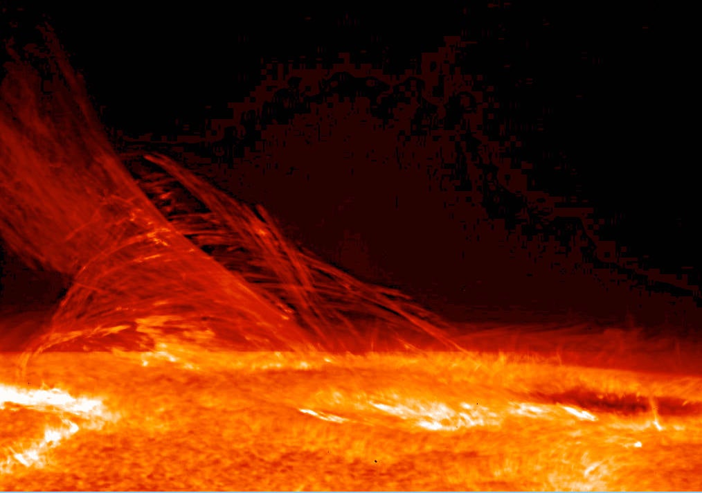
In SSO, satellites have a perpetual view of the Sun, which is great for making solar observations. And because Sun-synchronous satellites pass over the same spot each day, the downlinking of data is a cinch. NASA’s solar surveying Hinode satellite and Earth-observing Aqua satellite currently work in SSO.
SSO is “necessary for science because it keeps the angle of sunlight on the surface of the Earth as consistent as possible, though the angle will change from season to season,” NASA says. “This consistency means that scientists can compare images from the same season over several years without worrying too much about extreme changes in shadows and lighting, which can create illusions of change.” An absence of Sun-synchronous satellites would make it “impossible to collect the kind of consistent information required to study climate change,” according to the space agency.
Transfer orbits
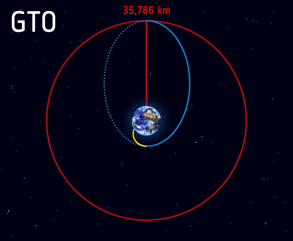
It’s not always possible to launch a satellite directly to its operational orbit, requiring the use of transfer orbits — temporary and elliptical circuits from which satellites can migrate to their desired orbits. When in transfer orbits, satellites or other spacecraft require very little energy from their thrusters or apogee motors to manoeuvre from one orbit to another, such as when using a geostationary transfer orbit to reach a geostationary orbit. An advantage of transfer orbits is that a payload doesn’t require a jumbo rocket to reach its operational orbit.
As a recent example, SpaceX used its Falcon 9 rocket to launch an Egyptian communications satellite to a transfer orbit some 45,000 km above Earth on June 8, 2022. The spacecraft used its own propulsion system to reach its operational orbit in GEO, where it’s now providing TV broadcast and internet services.
Graveyard orbits
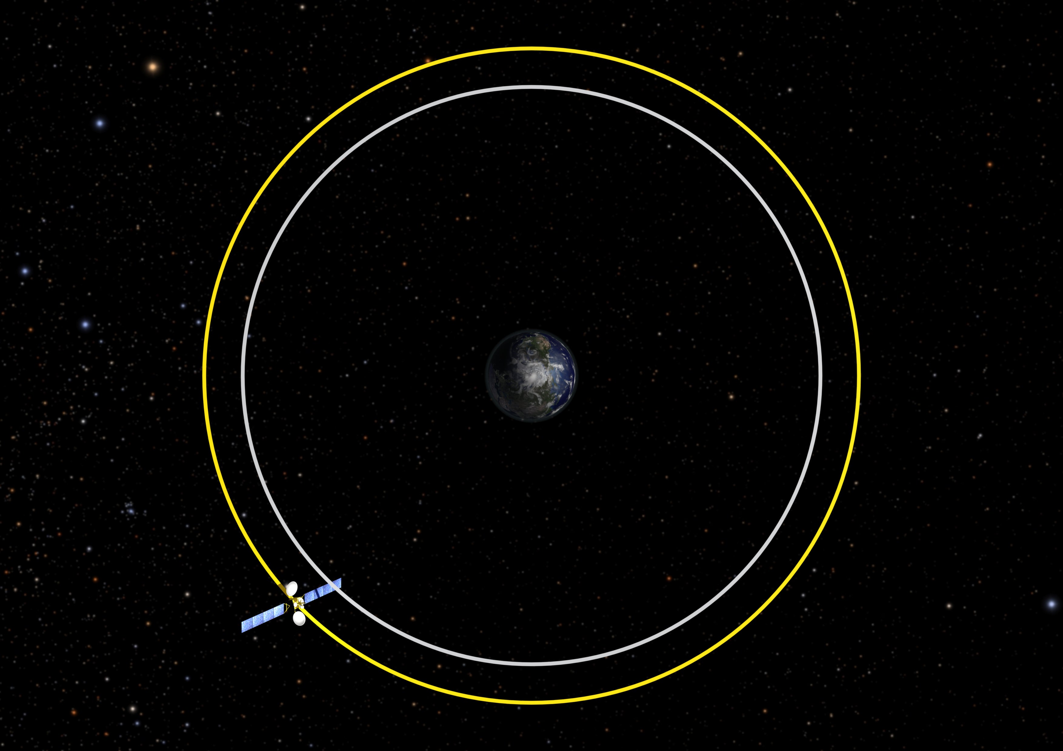
Current guidelines require satellite operators to dispose of their defunct satellites within 25 years (the Federal Communications Commission recently dropped this down to five years). In LEO, this is typically done by dropping decommissioned satellites down to the atmosphere, where they burn up on re-entry. It’s not always possible to do this, however; satellites in high orbits would need excess fuel to slow down, cutting their operational lives by a significant degree. That’s where the graveyard orbit comes into play, a band also known as the spacecraft cemetery or disposal orbit.
These satellites perform a final ascending fuel burn, sending them to the so-called graveyard. “Current U.S. guidelines require a spacecraft to be raised to an orbit at least 300 km [190 miles] higher, well out of the way of the busier operational orbits below,” according to NASA. As an example, the GOES-12 NOAA weather satellite entered into a graveyard orbit in August 2013 after 3,788 days in service.
Lagrange points (L-points)

For some spacecraft, such as space-based telescopes, it’s not ideal for them to be so close to Earth. Our planet emits visible light and infrared radiation, which can interfere with observations of distant stars and galaxies.
In those cases, we can send spacecraft to one of two Lagrange points — locations in space where the gravitational fields of Earth and the Sun combine to keep an object stable and in a fixed position relative to Earth. Technically speaking, these are solar orbits, but Earth is directly involved in generating these gravitational sweet spots.
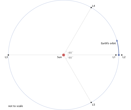
The first Lagrange point, L1, is located inside Earth’s orbit, while the second Lagrange point, L2, is behind Earth as viewed from the Sun. Both L1 and L2 are located 932,000 miles (1.5 million km) from Earth.
Spacecraft currently working in Sun-Earth L1 include NASA’s SOHO solar telescope and ESA’s gravitational wave detector, LISA Pathfinder. L2 is currently home to the Webb Space Telescope and ESA’s star-mapping GAIA observatory.
Lunar Orbit
Earth revolves around the Sun, and the Moon around Earth, but objects can also circle the Moon, creating yet another kind of Earth-related orbit. Lunar orbit, also known as selenocentric orbit, was supremely useful during the Apollo era, as the command and service module spun around the Moon while dispatching astronauts to the surface. NASA’s Lunar Reconnaissance Orbiter has been in lunar orbit since 2009, taking spectacular images of the natural satellite’s cratered terrain.
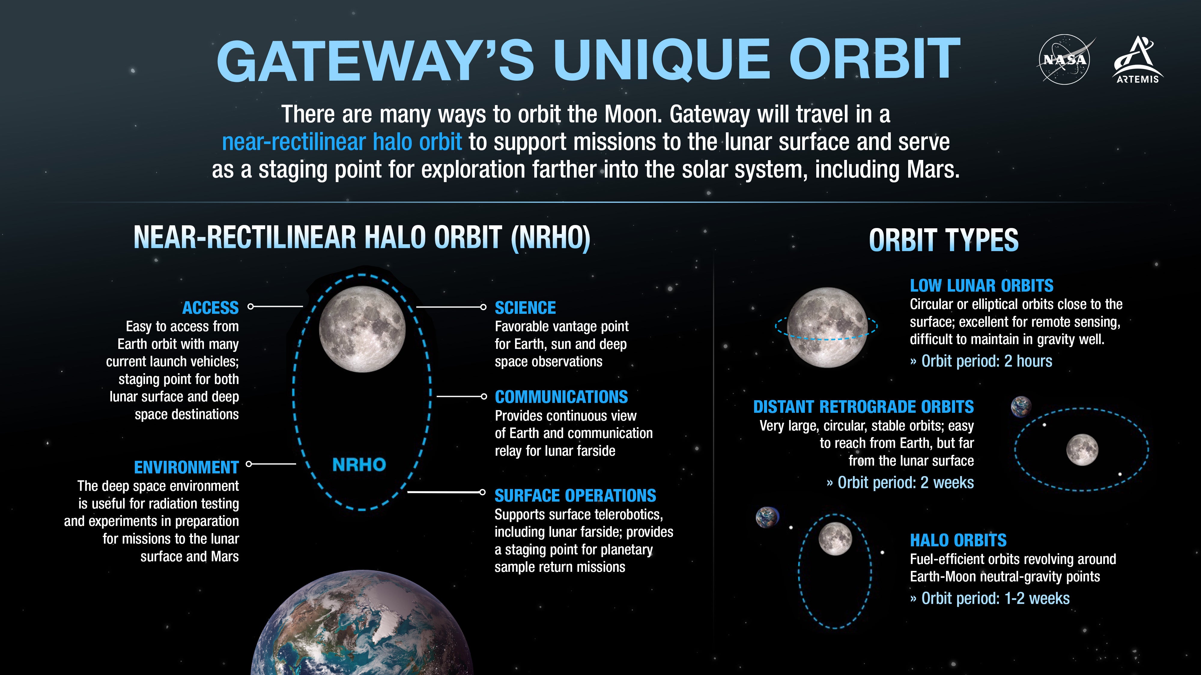
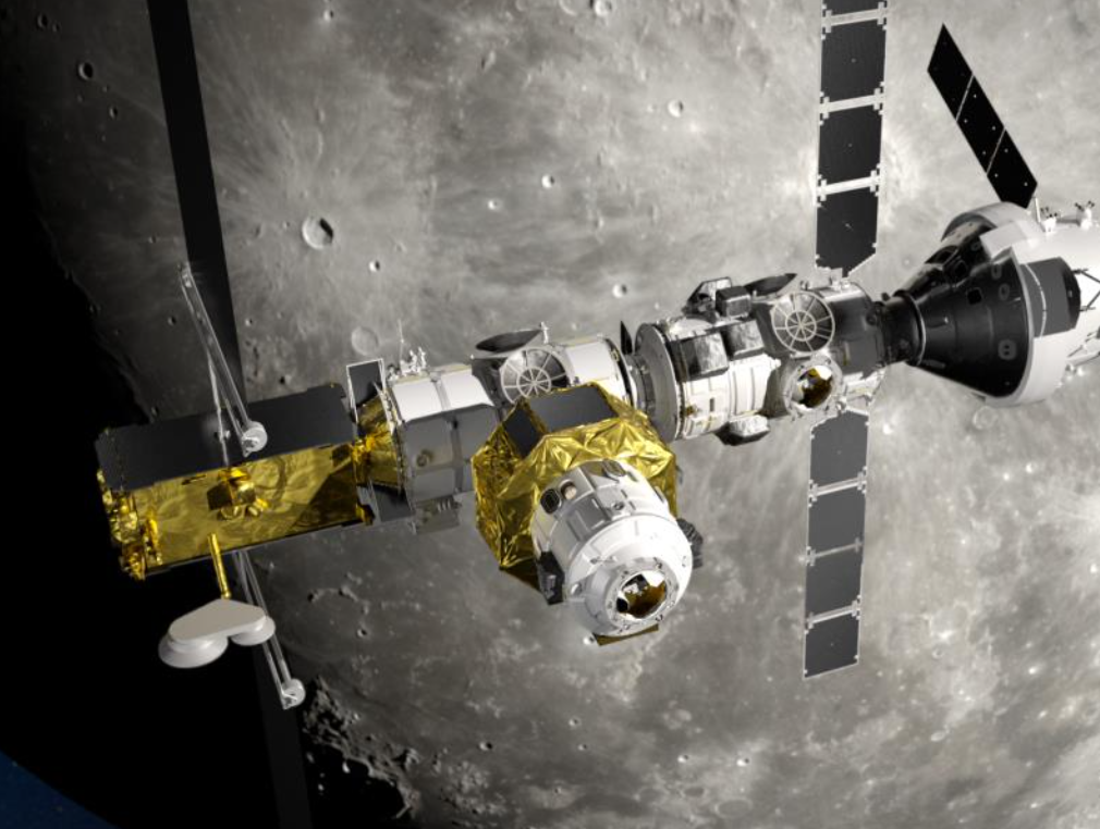
Like Earth, the Moon also has its distinct orbits (the NASA graphic above provides a quick overview). As part of the Artemis program, NASA and its partners are planning to build a space station, called Gateway, in a special lunar orbit known as a near-rectilinear halo orbit (NRHO). This highly elliptical seven-day orbit would bring Gateway to within 1,500 km of the lunar north pole during its closest approach. Spacecraft in NRHO will take advantage of neutral gravity points between the Earth and Moon, as it will require less fuel to remain there. NRHO is also ideal in that it will provide the lunar outpost with a continuous line of sight to Earth.