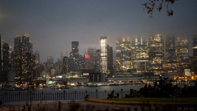
The ground beneath New York City is sinking and rising across different areas, new research shows. The sinking has contributed to worsening flood risks, including at sporting arenas, roadways, and a busy airport.
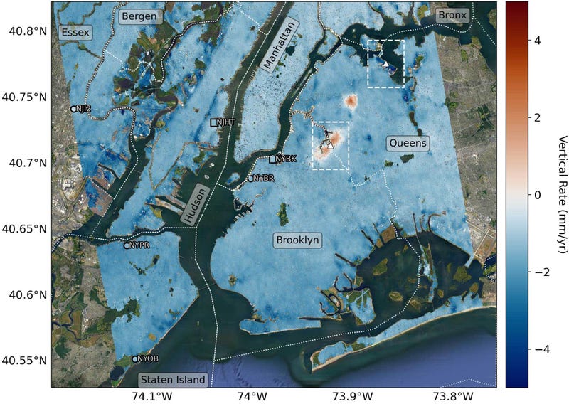
A study on the slight elevation changes throughout the city was published in the journal Science Advances last week. Researchers from NASA and Rutgers University documented the city rising and sinking at different rates from 2016 to 2023 by using a remote sensing technique called interferometric synthetic aperture radar (InSAR). This combines several 3D observations of a region to reveal changes over time.
Through those observations, the researchers found that the NYC metropolitan area is sinking at a median rate of about 1.6 millimetres a year. Several locations around the city, including Arthur Ashe Stadium in Queens, a runway at LaGuardia Airport, and Interstate 78 (this includes the Holland Tunnel), are sinking at a rate of more than 2 millimetres per year. That sounds tiny, but it adds up over time to increase flood risk throughout the city.
There’s an ancient reason for some of this sinking. During the most recent ice age, which ended over 11,000 years ago, much of the Northeast U.S. was covered in ice, a post from NASA explains; much of New York City sits on land that was once slightly elevated and is now coming back down. Development has also played a role. Some of the sinking locations, like LaGuardia Airport, were built on top of landfills. The sinking has occurred alongside a worsening climate crisis that has increased flooding from rising ocean levels and heavier rainfall. Sea levels around Manhattan rose by more than 4 millimetres a year between 2000 and 2022.
“The city has long dealt with coastal flooding from both hurricanes and extratropical storms, but as seen with Superstorm Sandy in 2012, storm surges associated with severe weather events are becoming more destructive because of ongoing sea level rise,” the study authors wrote. “The relative rise in sea level during the 20th century resulted in an additional $US8.1 billion in damages from Sandy than would have occurred a century prior.”
Residents have witnessed the consequences first hand. Despite billions of dollars of updates to LaGuardia Airport, that area has not been spared from damage due to extreme weather. Late last week, heavy rainfall over the NYC area created flash flooding in subway stations, across highways, and at the airport. Travellers had to wade through several inches of water in the terminals, NBC New York reported.
Researchers also found that some parts of New York are actually rising. They noted that Newton Creek in Brooklyn is rising at a rate of about 1.6 millimetres a year, while the neighbourhood of Woodside, Queens rose about 6.9 millimetres between May 2016 to December 2019.