We’ve been capturing space-based images of Earth for nearly three-quarters of a century, but these eight views of Earth are each profound in their own way.
Images of Earth from space are now so commonplace that it’s hard to fathom the pre-spaceflight era—a time when people were forced to use their imaginations instead. The first suborbital images of Earth were cause for celebration, but we could scarcely imagine what was to come. Within a few years and decades, we were snapping pics of Earth from the Moon, a neighbouring planet, and from deep within the solar system.
The first view of Earth from space
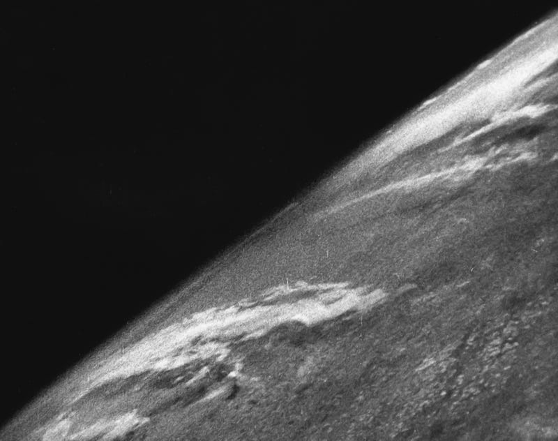
Hard to believe, but this photo of Earth, captured on October 24, 1946, was taken 11 years before the Soviet Union launched Sputnik to low Earth orbit. Our first view of Earth as seen from space, sadly, came from a camera mounted to a modified V-2 rocket (yes, the same V-2 rocket used by the Nazis to terrorize Britons during the Second World War). Launched from the White Sands Missile Range in White Sands New Mexico, the Project Hermes V-2 No. 13 rocket flew to a maximum height of 65 miles (105 km), from where it took a photo five times higher than the previous record.
The first view of Earth from the Moon
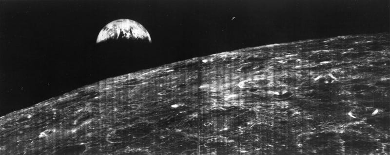
NASA’s Lunar Orbiter 1 was the first spacecraft to capture a view of Earth from the vicinity of the Moon. The orbiter took the image on August 23, 1966, during its 16th lunar orbit, transmitting the photo to NASA’s tracking station at Robledo De Chavela near Madrid, Spain.
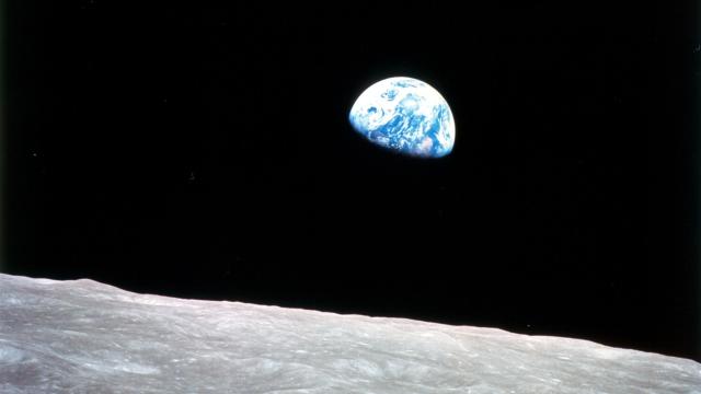
Earthrise
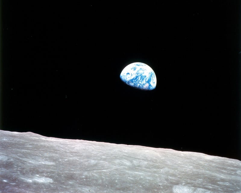
This iconic view of Earth, with the rugged lunar landscape in the foreground, was captured on December 24, 1968 during the crewed Apollo 8 mission to the Moon. Said NASA astronaut Jim Lovell at the time: “The vast loneliness is awe-inspiring and it makes you realize just what you have back there on Earth.”
The Blue Marble
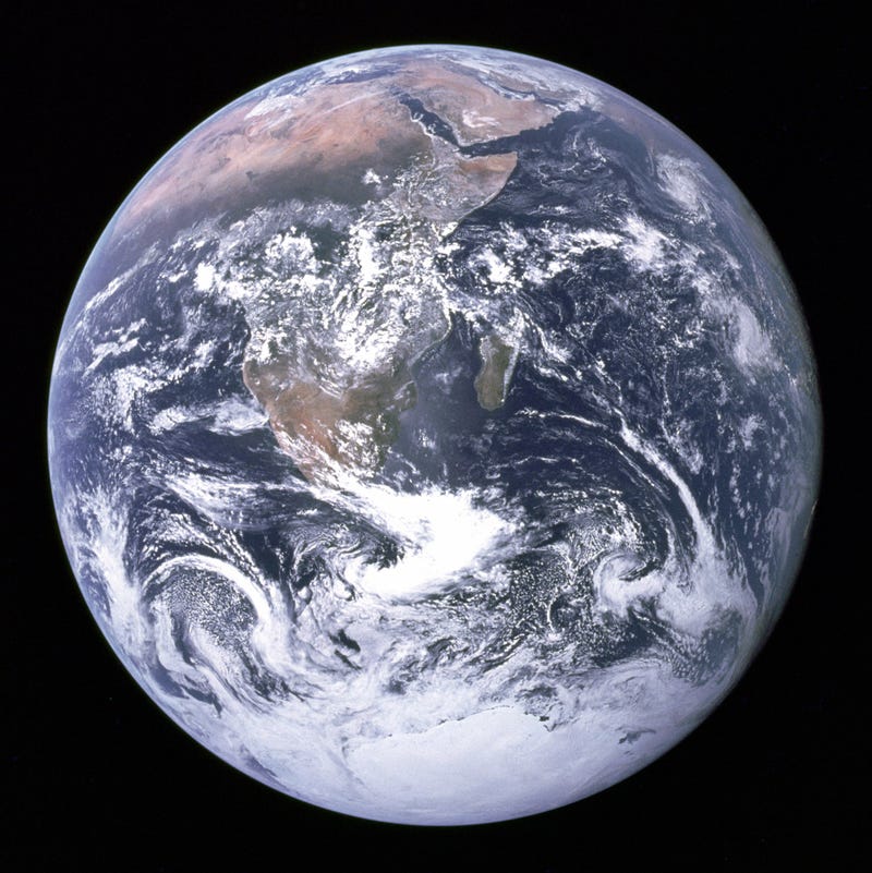
This is one of the most recognizable photos of Earth. Taken by the Apollo 17 crew on December 7, 1972, it shows our home planet in all its majestic glory. The NASA astronauts were heading home at the time, snapping the photo at a distance of 18,000 miles (29,000 kilometers). Africa and Madagascar can be seen in the frame, along with the Arabian Peninsula and Antarctica.
A view of Earth and the Moon in isolation
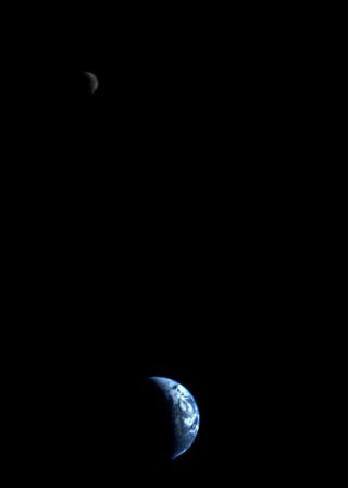
NASA’s Voyager 1 spacecraft took this parting shot of Earth and the Moon on September 18, 1977. It was our first-ever view of the two celestial bodies in isolation within a single frame. Voyager 1 was 7.25 million miles (11.66 million kilometers) from Earth at the time. The image was constructed from three photos, while the brightness of the Moon was enhanced for clarity.
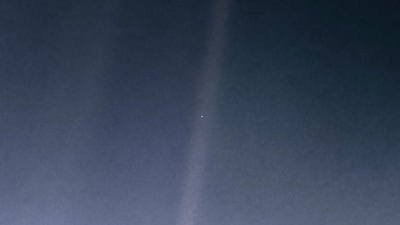
The farthest view of Earth from space
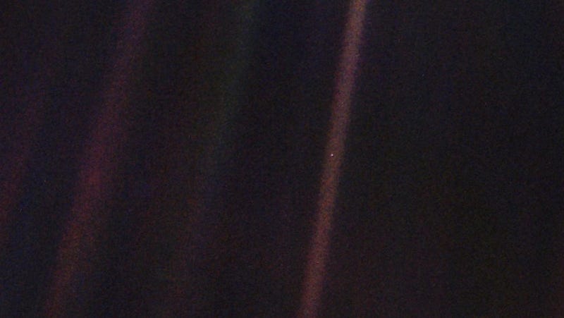
Voyager 1’s famous Pale Blue Dot, taken on February 14, 1990, remains the farthest view of Earth ever taken by a spacecraft. The NASA probe was 3.7 billion miles (6 billion kilometers) from the Sun at the time. Writing in his book Pale Blue Dot, Carl Sagan famously wrote: “Look again at that dot. That’s here. That’s home. That’s us.”
The first image of Earth as seen from another planet
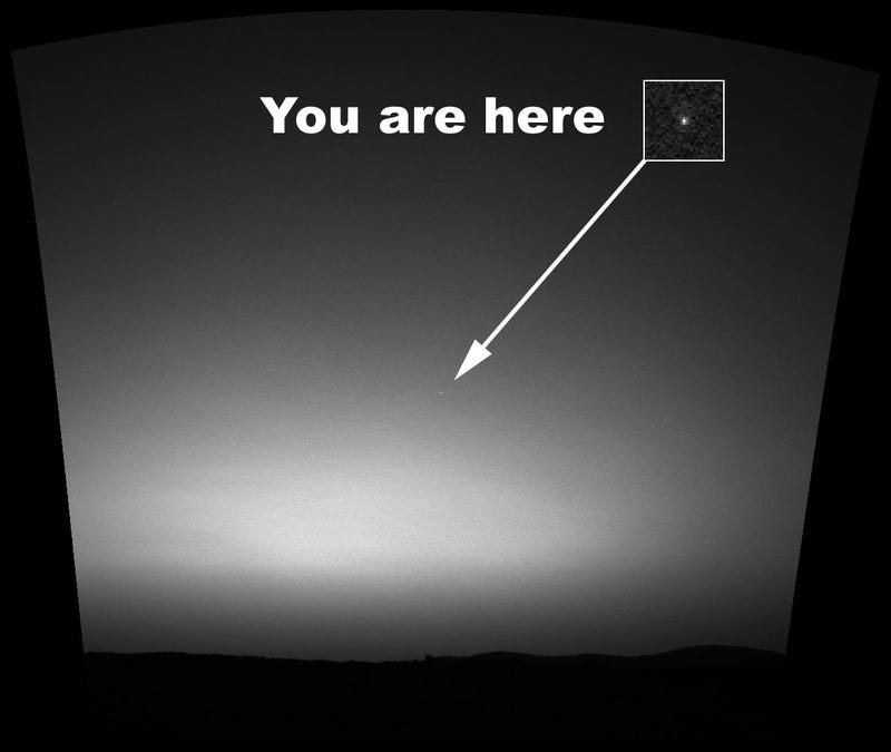
Behold the first image taken of Earth from the surface of another planet. NASA’s Spirit rover took the mosaic photo from Mars in early 2004.
Earth and the Moon as seen from the surface of Mars
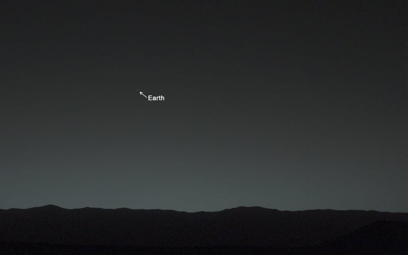
Curiosity one-upped the Spirit rover by capturing a view of both Earth and the Moon, which it did on January 31, 2014. The image, captured by the NASA rover’s Mastcam, was taken around 80 minutes after sunset, at which point Earth was the brightest object in the sky. The Red Planet was 99 million miles (160 million kilometers) from Earth when the image was taken.
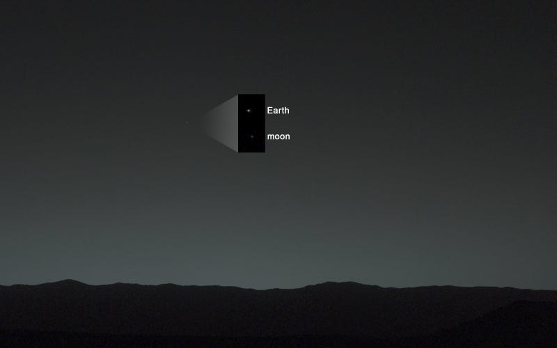
By zooming in and adding some background darkness (see annotated image above), the Moon could also be seen. “A human observer with normal vision, if standing on Mars, could easily see Earth and the moon as two distinct, bright evening stars,” according to NASA.
Earth, the Moon, Mars, and Venus as seen from Saturn
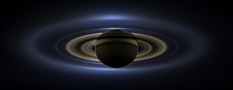
This epic mosaic image was captured by Cassini’s wide-angle and narrow-angle cameras on July 19, 2013. The NASA probe was so far at the time—898 million miles (1.46 billion km)—that Earth and the Moon appear as a single dot.
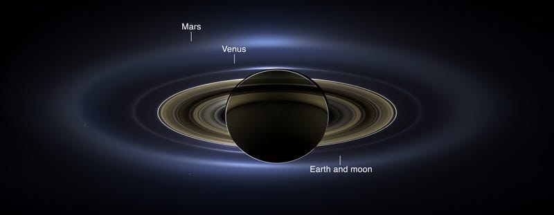
An annotated view of the image shows the location of Mars and Venus, along with Earth and the Moon. The bright dot to the left is Saturn’s moon Enceladus, while the bright dot at bottom-left is another Saturnian moon, Tethys. In total, at least 15 celestial objects or phenomena are visible in the frame, which NASA stitched together from 323 images.