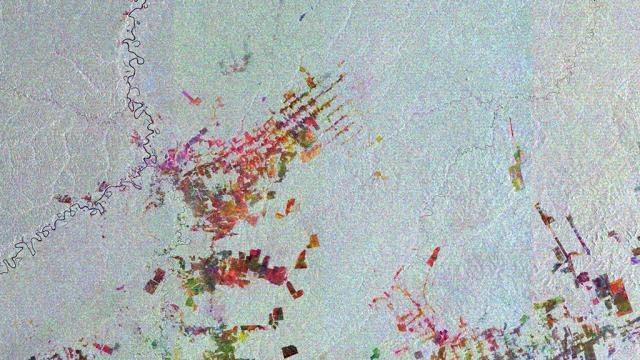
The city of Boca do Acre is a beautiful place to live, almost completely covered by the Amazon Rainforest — for now. Because you shouldn’t be fooled by the pretty colours in this image: it actually reveals the rapid rate of deforestation in the area.
It’s not the first example of deforestation visualisation we’ve seen, but it is incredibly fine-grained. It was generated by combining three images, the earliest dating back to October 2005, each of which was assigned a colour — red, green or blue. When combined, differences in colour reveal changes in the surface between the satellite’s passes. You should be able to see large, geometrically shaped features in the image: they’re plots cut out along linear roads, which used to be full of lush rainforest. Sigh. [ESA]