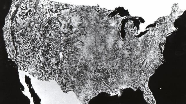
This might look like someone’s faxed a page of an atlas a dozen times, but you’re actually looking at the state-of-the-art from 1974. This is the first ever satellite image of the entire United States.
It was created for NASA by Department of Agriculture Soil Conservation Service Cartographic Division. The actual hard-copy image measured 10 by 16 feet, and was made up of 595 cloud-free black-and-white images returned from NASA’s first Earth Resources Technology Satellite. All the images were taken from 560 miles above the surface of Earth using the red part of the visible light spectrum, between July 25th and October 31st, 1972.
We may’ve moved on a long way since, but it remains impressive that this was made almost 40 years ago. [Internet Archive via Flowing Data]