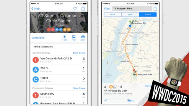
It’s the day we’ve all been waiting for — well, those of us who prefer not to drive — Apple adds transit directions to Maps. Let’s hope they actually work.
There are plenty of updates for Maps in iOS 9 but transit directions are by far the most overdue. Up until now, if you want to use Maps to route you via subway or bus, you’ll be directed to a third-party app. Now, in addition to selecting from walking or driving directions, hitting the little bus icon gives you clear door-to-door transit directions that include walking times as well. It will even tell you which subway entrance to use depending on which direction you’re going.
None of this is particularly revolutionary: Google Maps has had very good transit directions forever — and is even introducing real-time transit updates. But at least Apple is finally catching up. The launch is rolling out with San Francisco, New York, Washington DC, and Baltimore first, and several Chinese cities. Nothing for Australia, however. At least, not yet.
These certainly look pretty and I know that I’m excited to use them. The question remains, though, with so many great real-time transit tools like Nextbus and the dedicated apps that many cities have built themselves using their own public data, will anyone really use this tool? The directions to a nearby bus stop are nice, but the future is really knowing if that bus is actually coming right now.
