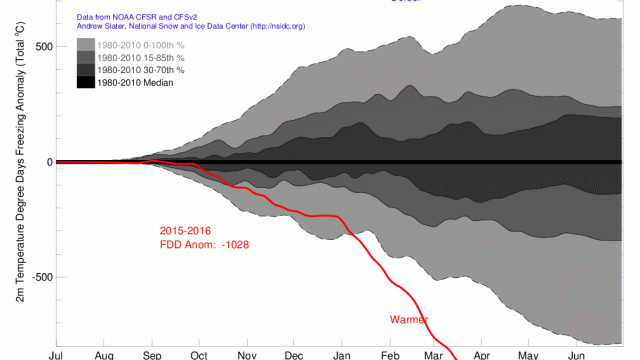
So far, 2016 has been a record hot year however you slice it — but the Arctic is on fire. A recently updated graph by the National Snow and Ice Data Center’s Andrew Slater shows just how freakishly warm it’s been in what is ostensibly one of the coldest regions of our planet.
Image: Andrew Slater/NSDIC
From the start of the year, degree days below freezing in the Arctic have been at the lowest levels since record keeping began in 1980. In other words, the Arctic is melting, fast and early. As Slate meteorologist Eric Holthaus noted on Twitter, we’re now, quite literally, off the charts:
This is how warm it’s been in the Arctic so far this year.
Literally off the charts, fewest freezing degree days. pic.twitter.com/mofdmTMLuL— Eric Holthaus (@EricHolthaus) May 26, 2016
This prolonged hot flash will come as no surprise to those who have been paying attention. After all, 2016 started out with a bang, as temperatures at the North Pole skirted the freezing point on New Year’s Eve. (They’re normally around 30C lower.) Back in March, the NSDIC announced that Arctic sea ice hit a record low this winter, and just last week, NOAA’s Barrow Observatory confirmed that it had recorded its earliest snowmelt date yet: May 13.
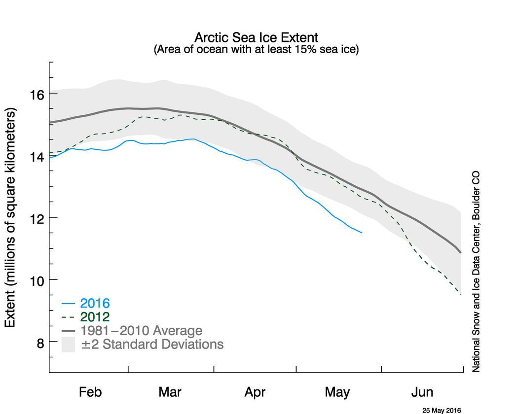
Image: National Snow and Ice Data Center
All signs are now pointing to a record low summertime sea ice extent, meaning more fresh meltwater entering the Arctic ocean and less reflective, icy surface to deflect the sun’s rays. The result? The Arctic absorbs even more heat and melts even faster.
The roof is on fire, and time is running out to fix it.