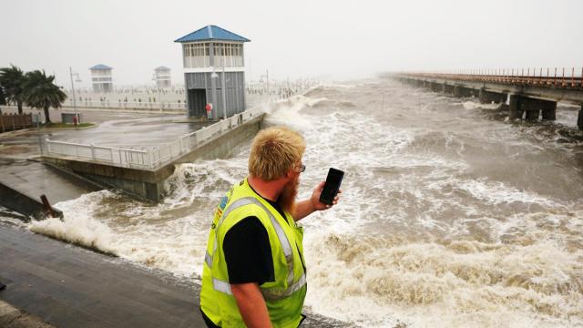
The incredible power of Hurricane Ida was on display on Sunday as the storm reversed the course of the mighty Mississippi.
The river temporarily flowed from south to north on Sunday afternoon after Ida made landfall as a Category 4 storm that underwent rapid intensification. Data from the U.S. Geological Survey shows that a river gauge at Belle Chasse, just southeast of New Orleans, recorded the stunning about-face of the Mississippi River.
The Mississippi was discharging roughly 9,910 cubic metres of water per second in the days prior to Ida’s arrival. Water moved upstream at a rate of 1,132 cubic metres per second. That’s a staggering amount of water to turn around. Ida is expected to push 5 metres of storm surge inland, with the highest inundation covering an area from the petrochemical hub of Port Fourchon to the mouth of the Mississippi. The turnaround of the river is indicative of how powerful that surge has been.
It’s a phenomenon we’ve seen with other storms, notably Hurricane Florence in 2018. That contributed to what’s known as compound flooding where storm surge pushes water inland where rain is falling. With water pushing ashore, there’s nowhere for the rain to drain.
With Ida, that could become a bigger concern as day turns into evening and the storm lingers. The National Hurricane Centre noted in its most recent forecast discussion that “Ida’s forward motion has slowed.” Slower motion means bands of rain can repeatedly sweep over a given location, leading to higher rainfall totals and more flooding.
Despite spending hours over land, Ida has also failed to weaken substantially. The storm is also still packing winds of 209 km/h, owing in part to what’s referred to as the brown ocean effect, which occurs when storms are able to suck up moisture from the land itself and maintain their strength even as they move inland. (The effect has even helped sustain a tropical cyclone all the way to the Great Lakes, albeit in a much weaker state than Ida.)
In the case of southeast Louisiana, “land” might be a generous statement; the region is mostly bayous and barrier islands that have become even more fragmented and watery due to the fossil fuel industry causing subsidence (in addition to the sea level rise caused by burning said oil and gas). The levee system and containment of the Mississippi River have led to further sinking in what scientists have said is a “worst case” scenario for the state.
There are lots of reasons to worry about that in the long term. But what it means now is that means there’s plenty of warm, shallow water to keep Ida fuelled up as it crawls northward. And even though the Mississippi has since un-reversed course, the storm still has plenty of damage left in its system.