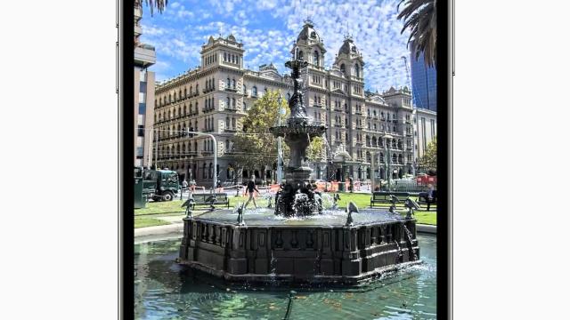
Hi, iPhone user here. While Apple’s phones have won my loyalty, a lot of their native apps haven’t. One in particular is Maps. But today, Apple has given me a reason to ditch Google Maps for its native Maps app.
Apple has today rolled out it an all-new Maps app in Australia. Why did it overhaul Maps? Because it wants to build the world’s best map, but its existing one was not that.
From today, users in Australia can experience the new Apple Maps, with the iPhone maker touting faster and more accurate navigation, and comprehensive views of things like roads, buildings, parks, airports and shopping centres. As well as three-dimensional landmarks of 45 locations, such as the Sydney Opera House.
“Apple Maps is the best way to explore and navigate the world, all while protecting your privacy. We are excited to bring this experience to even more users with today’s rollout in Australia,” said Eddy Cue, Apple’s senior vice president of Services.
“The map has been rebuilt from the ground up, with better navigation, richer detail, more accurate information for places, and remarkable features that only Apple can deliver, like Look Around, Share ETA, and more. Now it is easier than ever for users to find the places they love and get to where they’re going.”

So what’s new with Apple Maps in Australia?
After already rolling out the new Maps features in the U.S., UK, Ireland, Canada, Spain, Portugal and Italy, Apple is bringing augmented reality, city guides, a new Navigation experience and a bunch of other features to Australia, in addition to its all-new Maps.
Look Around
Look Around is Apple’s name for being able to interact at a street level with Maps. Street-level imagery has received a face-lift, with high-resolution, 3D photography and more smooth transitions now live. Through ‘Flyover’, you can see a number of major metro areas with photo-realistic, immersive 3D views. Indoor Maps for airports and shopping centres also allows you to see where exactly you are inside places like shopping centres or carparks.
Guides
Apple is focusing a lot on making Maps collaborative – this can be seen with its Guides feature. There’s a number of organisations signed up to be guides, Thrillist Australia and Time Out are two of them (basically, they make frequently updated lists of the ‘best X in town’ for you to follow their lead when you’re travelling).
Immersive Walking Directions
Users in Sydney and Melbourne will also soon be able to receive step-by-step walking guidance in augmented reality. Ya. Raising your iPhone to scan buildings in the area will generate directions but in AR.
New Navigation Experience
‘Siri Natural Language Guidance’ offers more natural-sounding directions (read: not overly American) that Apple says are easier to follow. This was actually one reason I switched to Google Maps – that Siri would tell me to turn left when I didn’t have enough time to get from the right lane.
Apple has (hopefully) fixed this, giving lane guidance in advance. It’s also adding speed and red light camera locations, bringing the ability for these locations to be crowdsourced. You can also tell Siri while you’re driving there’s an incident ahead.
Users can also ask Siri share an estimated time of arrival with other iPhone users, so I guess “I’m 10 minutes away” while still being home won’t fly anymore. This is pretty cool, however, because Maps will update your estimated time of arrival if there’s delays/traffic.
Providing you’re running iOS 15, the new Maps shows nearby stations better, in addition to real-time transit information that details schedules, live departure times, arrival times, the current location of a bus or train en route and system connections to help plan a journey. It will also display outages.
The new Apple Maps and features will begin rolling out today in Australia.
