Hurricane Ian continued to grow in size and strength overnight and is now one of the most powerful storms on record to ever hit the mainland United States. The hurricane is extremely dangerous and carries high risks of massive storm surges, heavy rainfall, flooding, and strong winds. Those who are under evacuation orders should leave their area immediately, if still possible.
“This one’s going to be catastrophic. It’s going to be life threatening in so many ways,” Joel Cline, the National Weather Service’s tropical program coordinator, told Earther.
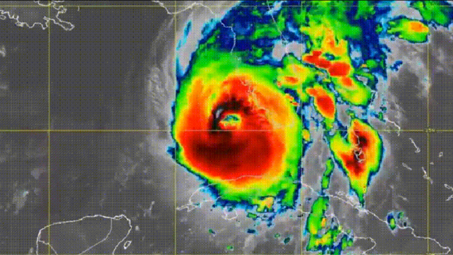
The storm is making landfall on the West Florida coast, currently centered off the coast, less than 32 km away from Sanibel Island. The eye of the hurricane is expected to be over land in the next few hours, near Port Charlotte, about 97 km southeast of St. Petersburg and 113 km southeast of Tampa, according to NOAA’s most recent public advisory.
The storm is at the high end of Category 4 categorization, with sustained winds of 249 km/h stretching out 64 km from the centre of the hurricane. Tropical storm force winds extend about 282 km out from the storm’s eye, Cline explained. But the winds are not necessarily the most dangerous part.
Surge has begun on Sanibel Island as the eyewall of #Ian approaches. Devastating.
Left, the normal view. Right, with the storm surge.
Water is the largest killer in hurricanes. Run from the water, hide from the wind.
Unfortunately, still time for this to rise even more. #flwx pic.twitter.com/5HNh1sBJAF
— Sean Macaday (@MacadayWX) September 28, 2022
Devastating storm surges of up to 18 feet are projected to hit sections of coastal Florida, with the worst surges forecast south of Ian’s centre from Englewood to Bonita Beach — encompassing the cities of Cape Coral and Fort Meyers. Elsewhere along the coast, expected storm surges range from 2 to 12 feet. Tampa Bay is now forecast to receive surges between 4 and 1.83 m.
I can’t overstate how serious the storm surge threat is in southwest Florida. #Ian will drive deadly surge into Cape Coral and Fort Myers, placing much of the area under water. If you live near the ocean in a surge zone, this is your last chance to leave… pic.twitter.com/FefKkoltd3
— Evan Fisher (@EFisherWX) September 28, 2022
On top of flooding caused by storm surges, the storm is forecast to bring heavy rainfall. Central and Northeast Florida should expect 12 to 18 inches, with some points being inundated by up to 2 feet of rain. “When you’re measuring rainfall amounts in feet instead of inches, that’s never good,” Cline emphasised.
Those precipitation totals are being intensified by the remnants of a cold front lingering over the northern part of the state. That front is expected to significantly slow the hurricane down once it’s over land, making it linger and hammer impacted regions with even more water, explained Cline.
A storm slowing down isn’t necessarily a good thing, echoed Noah Brauer, a meteorologist and hurricane researcher at the University of Oklahoma. Even when it might mean slightly lessened winds, slower storms lead to the same areas getting hit for longer by rain and winds.
Brauer spoke to Earther from Florida, while in a car on I-75 southeast of Tampa in Florida. He is in the area monitoring and studying Hurricane Ian and noted that he was surprised by how sharp the gradient of the storm currently is. “We’re probably located about 97 km from the actual eye of the storm, but we’re only seeing tropical storm force winds.” In his location, Brauer described that it was raining “pretty hard” but that winds were so far only blowing at about 30 to 45 mph. At the time of our call, there were still a number of cars out and about, driving on the highway, he said.
Though about 2.5 million people in the state have been under mandatory evacuation orders, some have opted to stay or been unable to leave.
Why did Hurricane Ian get so strong?
The storm made landfall in Cuba yesterday, knocking out the entire electrical grid for the island’s 11 million people and causing widespread damage. After Cuba, the hurricane picked up even more strength.
It passed over a particularly deep and warm area of the Gulf of Mexico called the Loop Current, which lent it more moisture and energy, said Brauer. The Gulf’s sea surface temperature this fall is above average, he added, which likely also contributed to Ian’s intensification.
Further, Ian is the first major storm to pass through the Gulf so far this year, explained Brauer. Without earlier hurricanes entering the region and stirring up the water column, the warmest water has stayed in place and accumulated at the surface, he said. Hurricanes derive their power from ocean and atmospheric heat, so warm sea surface temperature is a particular driver of strong storms.
Only four hurricanes on record have ever been stronger when they made landfall in the mainland U.S., Jake Carstens, a meteorologist and hurricane scientist at Pennsylvania State University, wrote in an email to Earther. “It will likely be the sixth Category 4 or 5 hurricane to hit the continental US since 2017, the most in any 6-year period on record.”
“Ian would be the strongest hurricane on record to hit southwest Florida, and its size is much larger than 2004’s Charley, often considered the most impactful recent storm in that area,” Carstens added. He called Ian a “generational storm for southwestern Florida” and emphasised that its impacts will reverberate throughout the state.
Although the link between Hurricane Ian and climate change cannot yet be established, previous research has found that human-caused climate change is intensifying Atlantic hurricanes, making for wetter storms and larger storm surges.