The earthquake that struck Turkey and Syria on February 6, 2023 caused widespread devastation and killed more than 50,000 people. Now, a team of geoscientists have released striking images and drone footage of the fault line that shifted the ground across the region, and used it to map how the quake started and spread.
Published today in the journal Science, the research details how ruptures on Earth’s surface propagated along the quake fault lines. The team notes that the initial quake occurred on the Dead Sea fault zone, but the largest quake happened when that energy moved to the East Anatolian fault zone. Click through to see their photos and videos of the unmistakable split that appeared with the disaster.
A ground rupture
A ground rupture stretching across farmland in eastern Turkey. This image was taken on March 10, 2023, a little over a month after the quake.
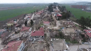
Çiğli after the earthquake
The town of Çiğli in eastern Turkey, 16 days after the earthquake. The ground’s movement caused some buildings to collapse.
A fault line from the air
Here, drone video captures a fault line stretching across a field near a settlement.
Offset in an olive grove
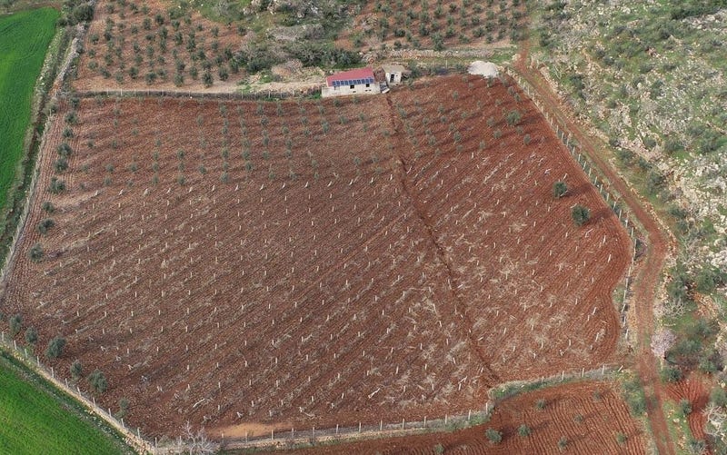
A drone image reveals a fault line running through an olive grove in eastern Turkey, 30 days after the quake.
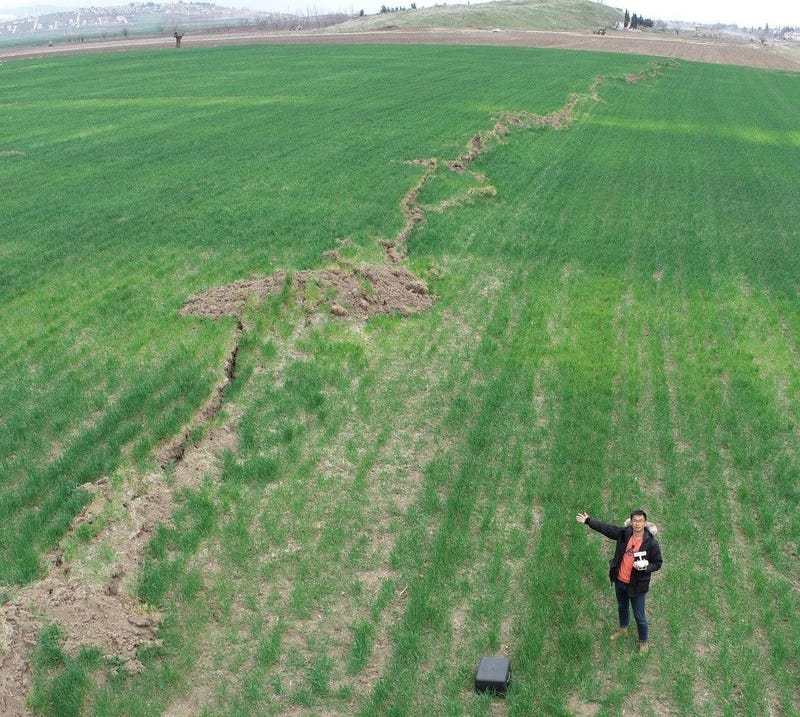
Fields
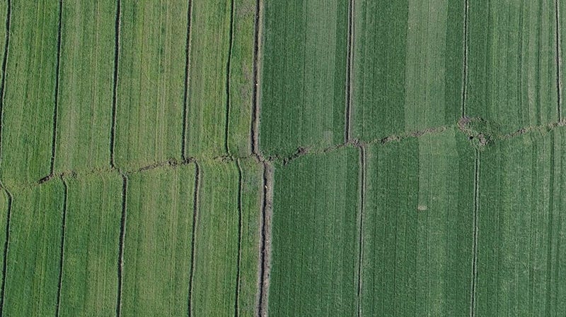
This drone image taken 18 days after the earthquake shows significant ground offset in fields in eastern Turkey.
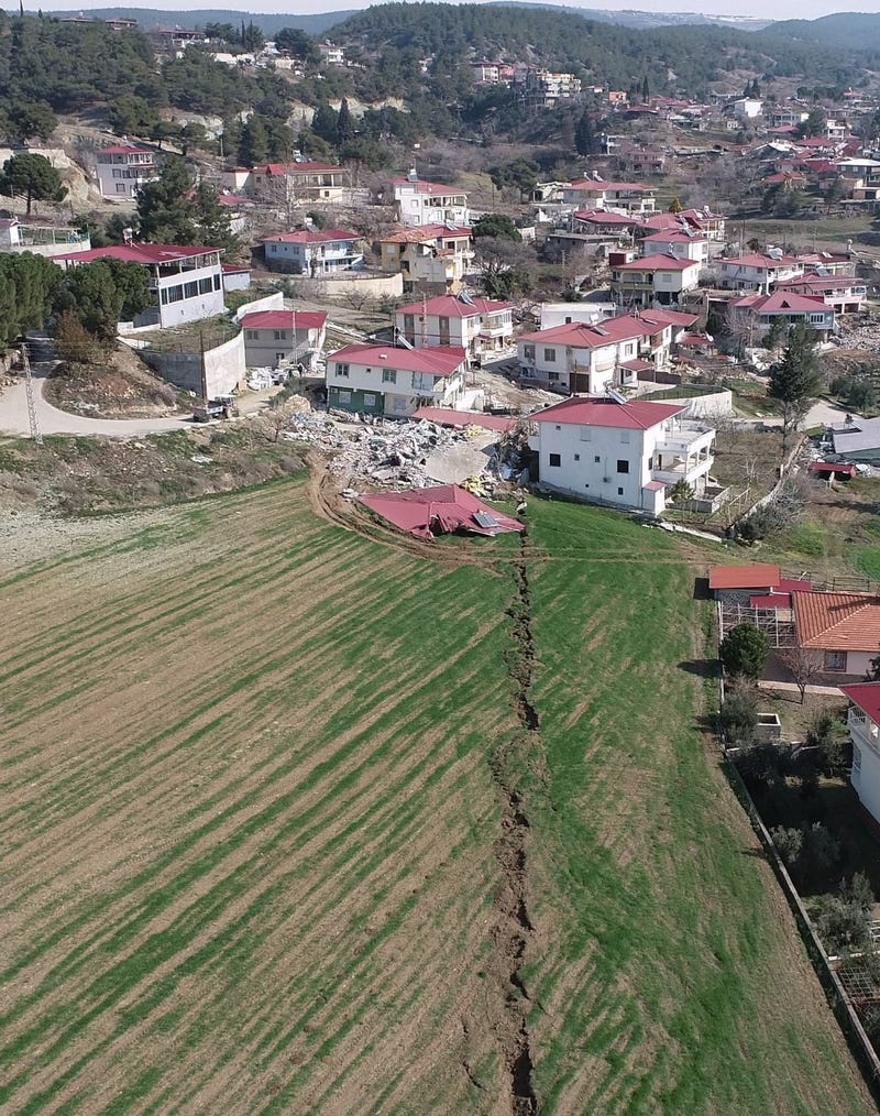
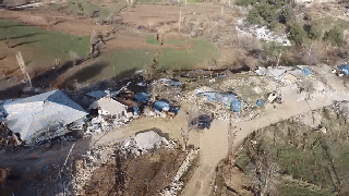
The fault line through a town
Drone footage shows devastation in a town in eastern Turkey, before revealing the fault line that stretches from a passing road into a field beyond.
A scarp in the mountains

12 days after the earthquake, the research team looked for features of ground displacement in eastern Turkey. Here, the fault is straddled by a geologist.
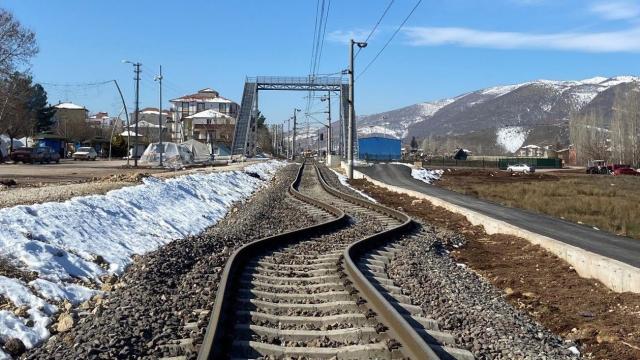
Warped railroad tracks
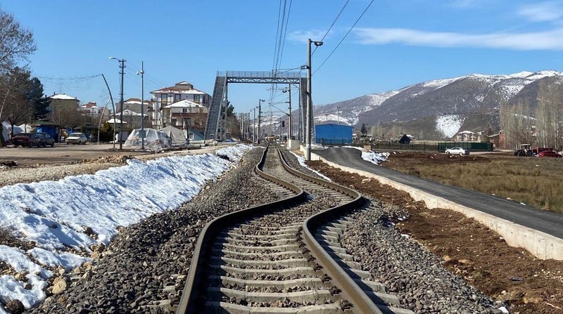
Railroad track in Turkey, deformed by the quake’s ground shaking and liquefaction. The track in this shot has shifted about 6.5 feet (2 meters).