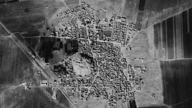
CORONA was the codename for the United States’ first photographic spy satellite mission. For 12 years, it brought back intel on the USSR, China and the Middle East. But that wasn’t all its grainy, black and white images captured — it turns out it also caught an incredible number of undiscovered ancient settlements.
In a fantastic story on National Geographic, Dan Vergano reports on the Society for American Archaeology’s annual meeting, where a team from the University of Arkansas presented a study showing how the declassified CORONA images from the Middle East actually reveal an incredible wealth of previously-unknown ruins, from Bronze Age cities to ruined canals and roads across Syria and Turkey.
“We have a real way with all these sites to look across the whole Middle East and see how it was connected,” one researcher tells Vergano. Another major upside to using outdated footage? It was taken before most modern development in these areas, which may have obscured the sites since:
The Corona images, he explains, were made before cities such as Mosul in Iraq and Amman in Jordan overran the many archaeological sites near them. Dams have also flooded river valleys, covering many other archaeological sites. As cities grew, the industrial farming and irrigation that supported them grew too, obscuring roads and sites clearly visible in the spy-satellite images.
So, what’s next? Well, the team from Arkansas’ Center for Advanced Spatial Technologies have built a free, public tool to explore the footage — you can access that here. But the team says they want to delve into the rest of CORONA’s footage, too. Now we’ve parsed the Fertile Crescent, but who knows what the US’ spy satellites might have captured over Russia or China? [National Geographic]
Lead image: Internet Archaeology.
