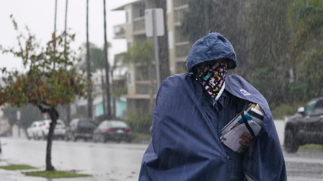
The new normal for California is no normal.
After enduring the worst wildfire season in history that extended into the start of the wet season, the state is about to get absolutely hosed with wind, rain, and up to multiple feet of snow as an atmospheric river roars across the Pacific. The scars left behind by 2020’s wildfires could be the site of massive debris flows that put those living downslope — people who already made it through the flames — at risk anew.
A coil of moisture-laden air is snapping like a whip from the tropical Pacific toward California. Known as an atmospheric river, the rain and snow are expected to reach the Golden State’s shores on Tuesday and unleash torrential rain and heavy snow across the northern two-thirds of the state throughout the week. The National Weather Service’s watches and warning maps look like someone took a box of crayons and decided to use every one of them to colour the state. There are winter storm, flash flood, freeze, hard freeze, high wind, gale, and high surf watches and warnings (among others) across the state.
[referenced id=”1442526″ url=”https://gizmodo.com.au/2020/09/where-do-we-go-from-here/” thumb=”https://gizmodo.com.au/wp-content/uploads/2020/09/12/mgoc5mqs5gh1c2lcrbuq-300×169.jpg” title=”Where Do We Go From Here?” excerpt=”After Sen. Ed Markey won his primary in Massachusetts earlier this month, he had a message: “The age of incrementalism is over.””]
On the winter storm front, snowfall totals could be eye-popping in parts of the Sierras. Up to 2.4 metres could fall in the highest elevations. The heavy snow is also raising the risk of avalanches (which is yet another shade on the U.S. National Weather Service map). Cold air accompanying the atmospheric river’s arrival could also lead to a few flakes flying in the lower elevation foothills as the storm gets underway.
Closer to the coast, it will be all rain. While it will be measured in inches rather than feet — though some areas could see a foot of rain — the rainfall rates could pose a significant risk. That’s particularly true of areas around Santa Cruz where massive burn scars from this summer’s lightning-sparked fire siege have left mountains of debris that can easily turn into mudslides. The dry start to the wet season has also hardened soil so that it can’t easily absorb water, upping the risk of catastrophic runoff.
The National Weather Service is warning rainfall rates there will be high enough to spark debris flows, which can be extremely dangerous. In 2018, heavy rains fell in fire-stricken areas and unleashed deadly mudslides across Southern California. The state has issued mandatory evacuation orders for up to 5,000 living in the Santa Cruz area ahead of the storm’s arrival.
The whiplash of California going from record fires and dryness to heavy rain is jarring, and exactly in line with climate projections as the planet heats up. While average precipitation isn’t expected to change much in California, research suggests that extremely dry and wet years will become more common. That means the risks we’re seeing now of heavy rain on areas burned just a few months earlier is only likely to increase. That points to the need to prepare communities, water systems, wildfire management plans, and more to handle the increasingly erratic weather.
