This week a dust storm so ridiculously huge that it was visible from space tore through Colorado. The National Oceanic and Atmospheric Administration’s GOES-East satellite captured a two-hour timelapse of the storm, which you can see above.
On Friday the National Weather Service in Pueblo said gusty north winds exceeded 60 mph (96 kph) and a dust storm warning remained in effect in southeastern Colorado throughout the morning and early afternoon. The National Weather Service also issued a “blowing dust warning” for the region on Friday, and said the strong winds increased “critical fire danger,” per the Denver Post.
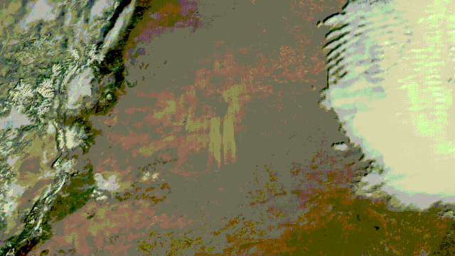
Here are two other ways to visualize the dust from #GOESEast:
Dust RGB to the left, where the dust appears dark pink, and DEBRA (Dynamic Enhancement with Background Reduction Algorithm) to the right, where the dust appears yellow.
Winds are currently gusting at over 50 mph. pic.twitter.com/lw68fUhALM
— NOAA Satellites (@NOAASatellites) January 15, 2021
The storm severely limited visibility on major roadways. Videos shared by Colorado State Patrol of cars pulled off to the side of the road look like scenes straight out of a Mad Max movie, the skyline dissipated by a thick cloud of dust clogging the air.
Windy conditions, low visibility, and a fatal crash shut down a stretch of highway in both directions that runs from Denver to the Kansas state border. The crash killed one person and injured up to 15 others, Colorado State Patrol tweeted. The interstate remained blocked for more than three hours, a Colorado Department of Transportation spokesperson told the Denver Post.
Winds were also high in the days leading up to the storm. Across Wednesday night and into Thursday morning, officials reported gusts of more than 90 mph (144 kph) in parts of Boulder and Larimer counties and 116 mph (186 kph) winds near the town of Breckenridge, according to local NBC affiliate 9News.