Following the collapse of the Nova Kakhovka dam in Ukraine this week, satellite imagery shows just how dire the situation really is.
Ukrainian president Volodymyr Zelensky called the collapse “an environmental bomb of mass destruction,” CNN reports, as flowing water threatens nearby crops and villages, causing more than 1,400 people to flee their homes. Satellite imagery sent to Gizmodo from Planet Labs shows the extent of the damage as a result of the collapse.
Before: The Nova Kakhovka dam in Ukraine on June 4, 2023
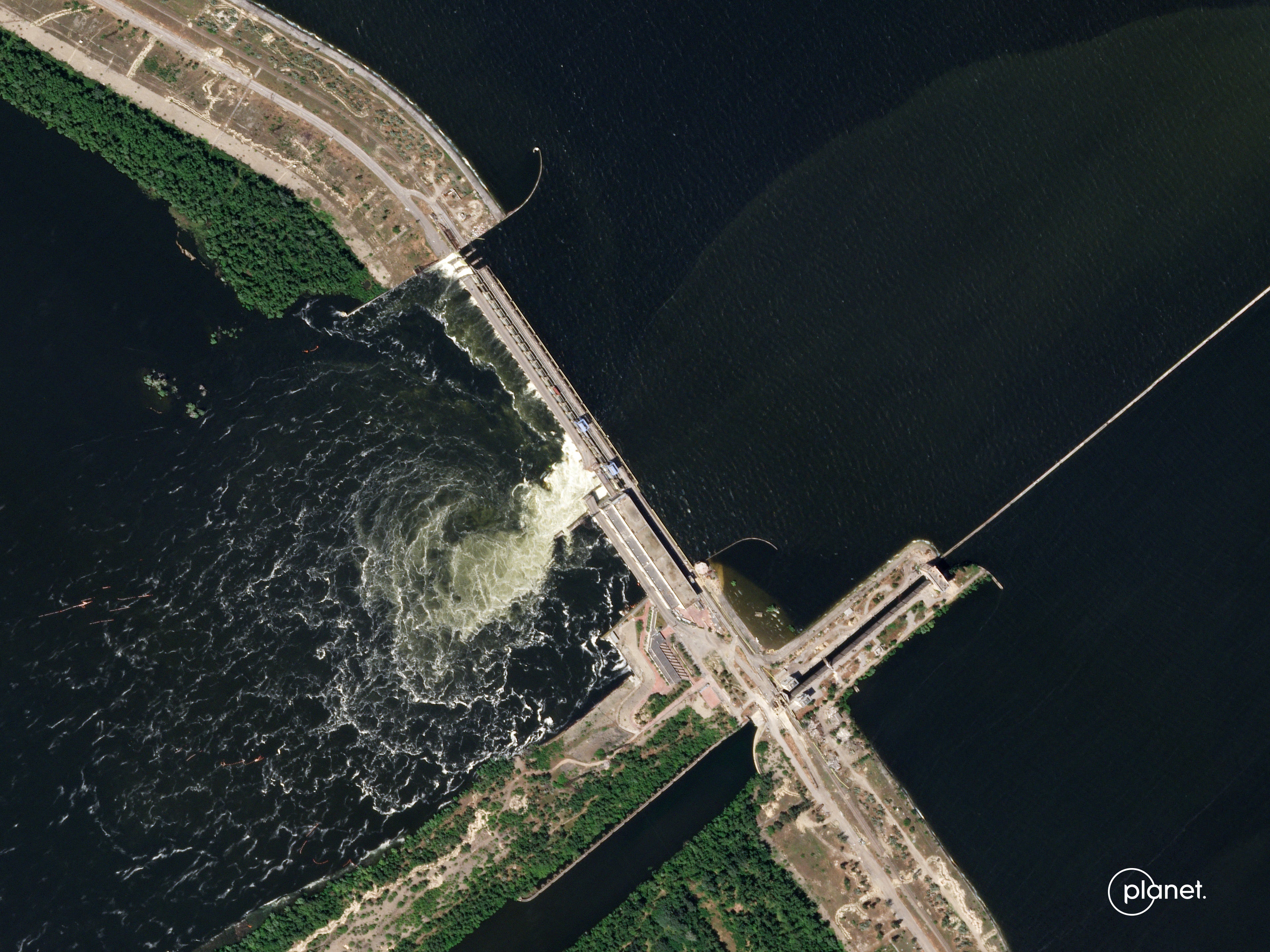
The hydro-electric dam was reportedly occupied by Russian forces, and both Russia and Ukraine are pointing fingers at each other. No evidence has been revealed regarding whether this collapse was a coordinated attack or an engineering failure.
After: The dam on June 6, 2023 following the collapse
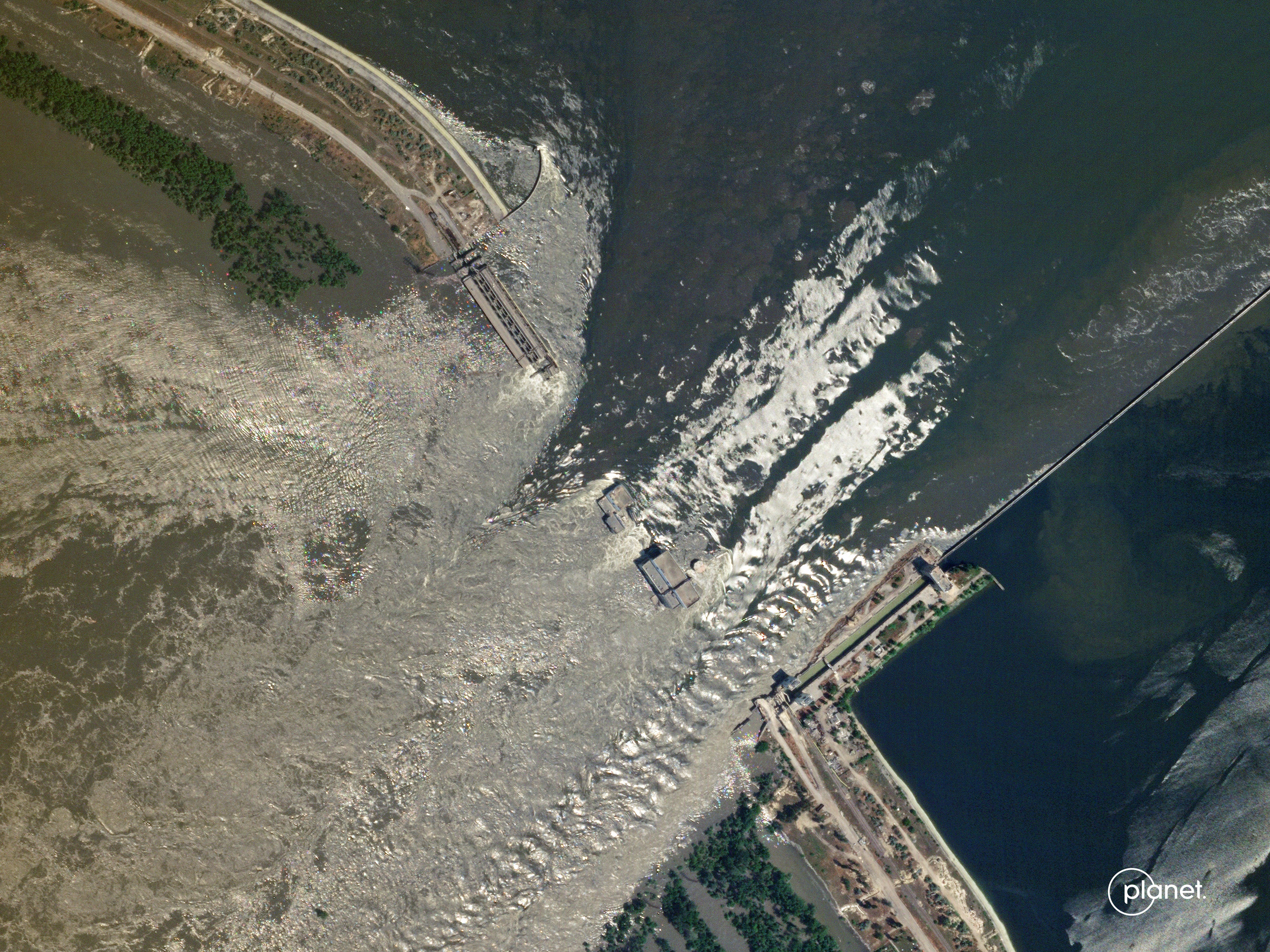
According to Associated Press, both Russian and Ukraine officials have called the incident an “ecological disaster” and a “terrorist act.”
Before: The city of Nova Khakova lines the southern river bank on June 5, 2023
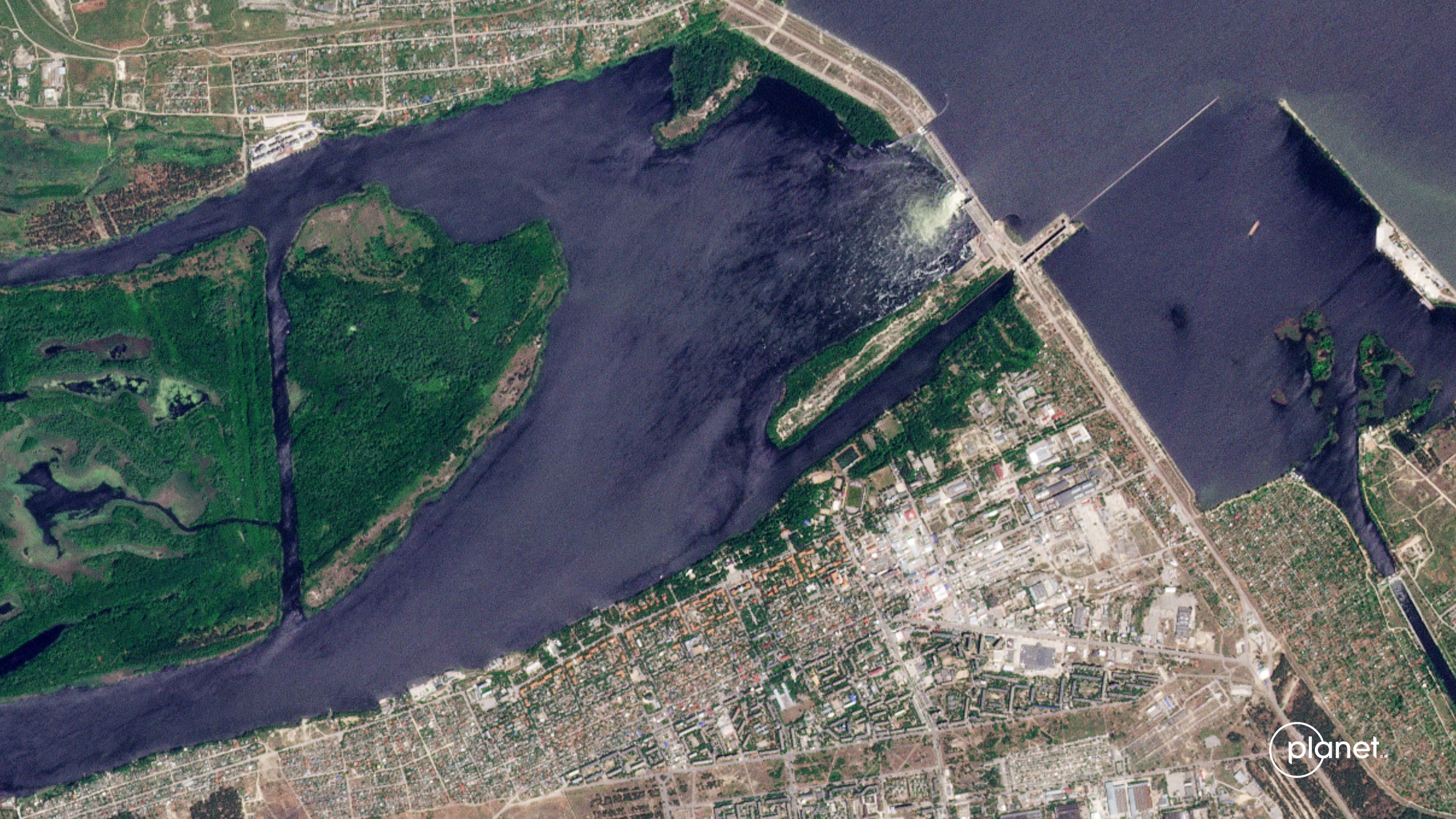
“The consequences of the tragedy will be clear in a week. When the water goes away, it will become clear what is left and what will happen next,” Zelensky said, as quoted by CNN.
After: River water floods the city of Nova Khakova on June 6, 2023
AP reports that Zelensky also called the collapse “the largest man-made environmental disaster in Europe in decades.”
Before: Dnipro River in Ukraine on June 5, 2023
Nova Kakhovka dam is located on the Dnipro river, which runs through Ukraine and hosts the capital city of Kyiv on its bank. In the image above, the dam can be seen along the far right.
After: Dnipro River inundating local farms and communities on June 6, 2023
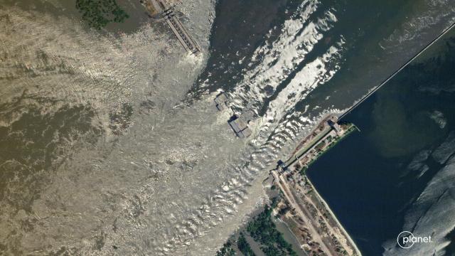
The dam is located downstream from Kyiv in the southern part of the country, about 40 miles (64 kilometers) away from the river’s outlet, the Black Sea
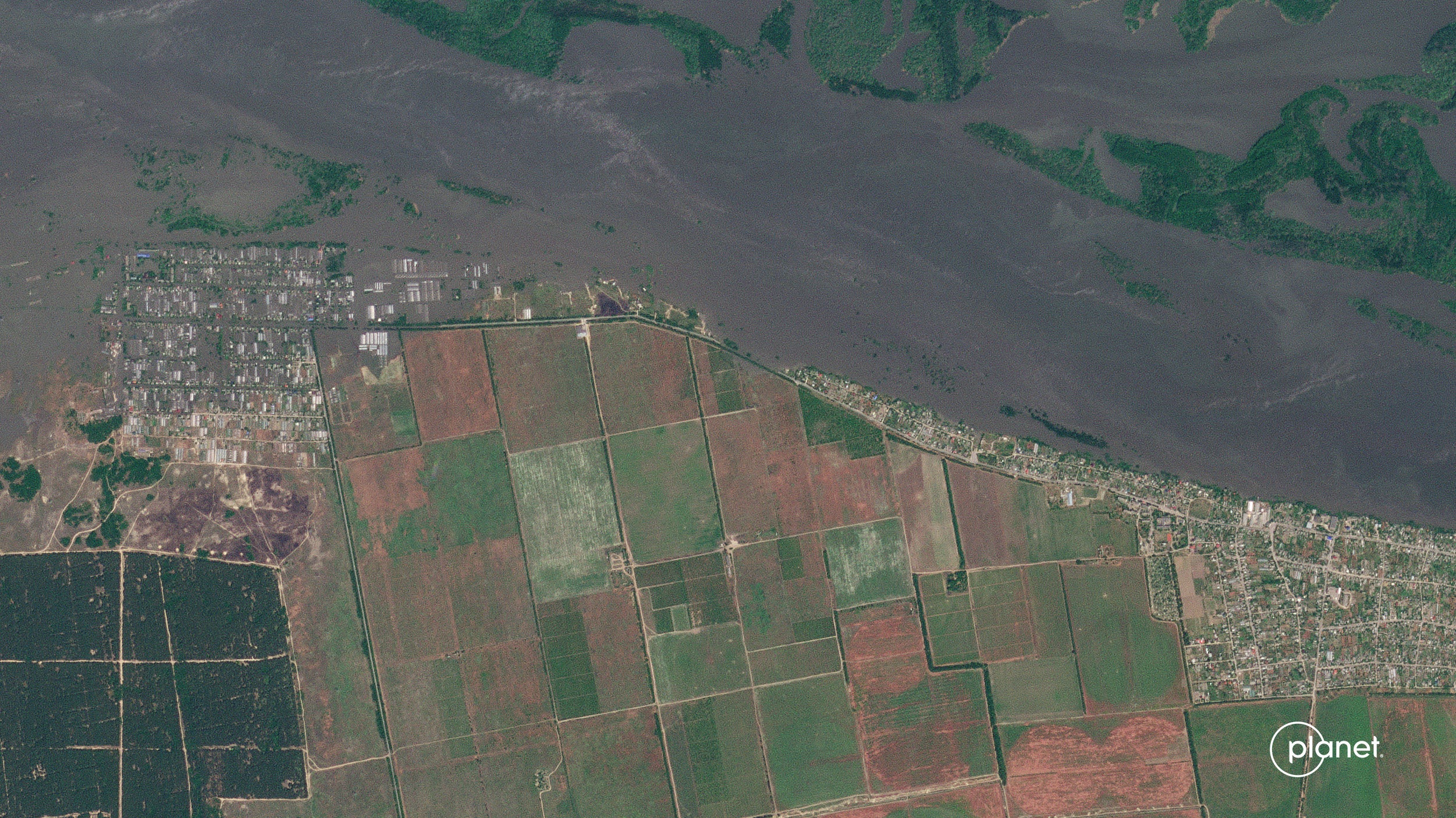
Before: Korsunka, Ukraine on June 5, 2023
As Associated Press describes, the south side of the river is Russian-controlled, while Ukrainian counter-offences are occurring downstream of the dam.
After: Korsunka inundated with floodwater on June 6, 2023
It may not be a coincidence that Russia’s alleged attack on the dam occurred days after Ukraine’s counter-offensive began in earnest. Sadly, there may be more of this to come in the following weeks and months.