Google Maps is a brilliant app. It’s the go-to navigation tool for many people, whether it be for car navigation, public transport options, or for general location information, but there’s an absolute bunch of things you can do with it.
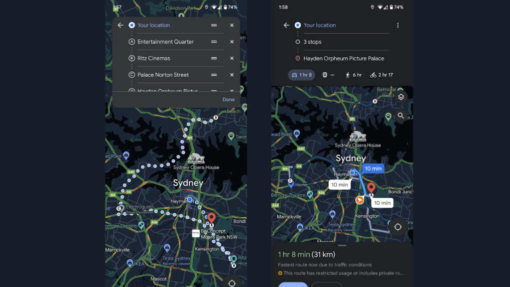
Add multiple stops
This is a short and simple one; if you’re planning a trip with several stops along the way, then you can input multiple stops when calculating your travel. Simply input your destination into the search bar, and then tap ‘directions’, followed by the three verticle dots in the top right corner. Then, click ‘Add Stop’, and input your next destination. Give it a try – you can have heaps of stops programmed for your journey.
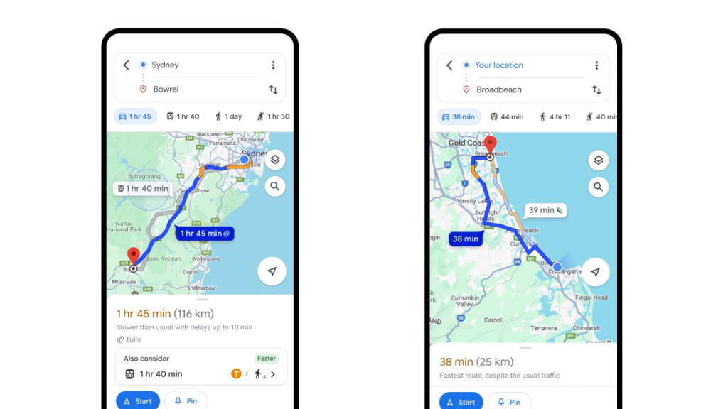
Find the most efficient travel route
For Earth Day 2024, Google rolled out a new feature that shows the most fuel or energy-efficient route, if it isn’t already the quickest option. It’s also rolling out a new ‘driving alternatives’ feature, where the app will start showing travel alternatives to driving, when travel time is “comparable and practical”. This feature is starting out in Sydney and Melbourne, along with 13 other cities.
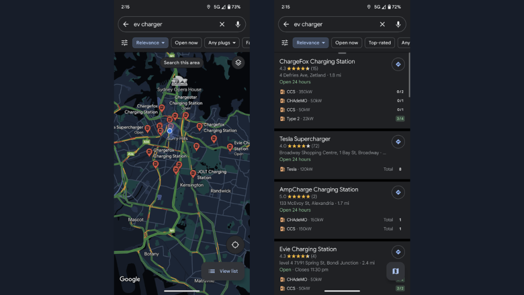
Find EV chargers
If you’re an electric vehicle driver, or even if you’re not but you’re interested in charging options along a specific route or in your local area, then you should use Google Maps to look for nearby chargers. Simply type ‘EV Charger’ into the Google Maps search bar, and you’ll receive EV charger information either along your route (if inputting a stop) or in your local area. What’s more is that Google Maps also shows the amount of chargers available at any given stop, and what speeds the chargers can operate at. You can also use Plugshare.
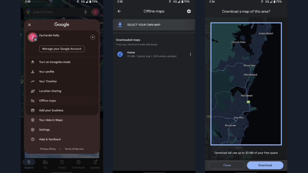
Use Google Maps offline
Worried about not having mobile coverage on a trip? Don’t worry, you can download a map for use offline, but be aware that you won’t have access to live travel updates. To use offline maps, tap your profile photo in the top right, and then tap ‘Offline Maps’. Then tap ‘Select Your Own Map’, and then zoom in or out of the area you want to have maps access to without data. It’s that simple, but the map will take up data on your phone.
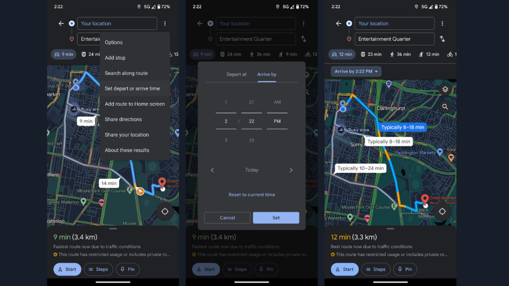
Plan your travel for a specific time
Another simple one; if you want to calculate how long it would travel from A to B at a specific time, know that Google Maps offers this functionality. Simply type in your destination, then hit directions, then he verticle dots in the top right corner, followed by ‘Set depart or arrive time’. Depending on your selection, you’ll see estimated travel times and route congestion along the way.
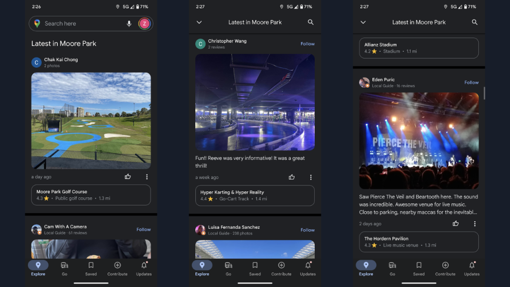
View the latest in an area on Google Maps
You’ve probably noticed the ‘Latest’ tab at the bottom of the Google Maps app that’s visible when you open the app or when you don’t have anything typed into the search bar – it’s actually quite useful. Depending on the area your Maps screen is currently displaying (as in, the suburb you’re currently getting a birds-eye view of), you can view the latest user-curated photos, restaurants, reviews, videos and more. It’s great if you’re hovering an idyllic part of the world in Maps and want to see what it’s like from the ground, according to users just like yourself.
Live View walking
When you’re travelling on foot, you can now use Google Maps to view directions in an augmented reality environment. This works by using your phone camera – with your phone camera pointed forward, arrows are positioned on the screen to direct you the right way. This is mostly rolled out for outdoor routes, although some indoor directions are live in Australia. You can use Live View by tapping ‘directions’ when you search for your destination. Select the ‘Walking’ icon, and tap ‘Live View’, with camera permissions enabled. Be careful of traffic and your surroundings when using this feature, of course.
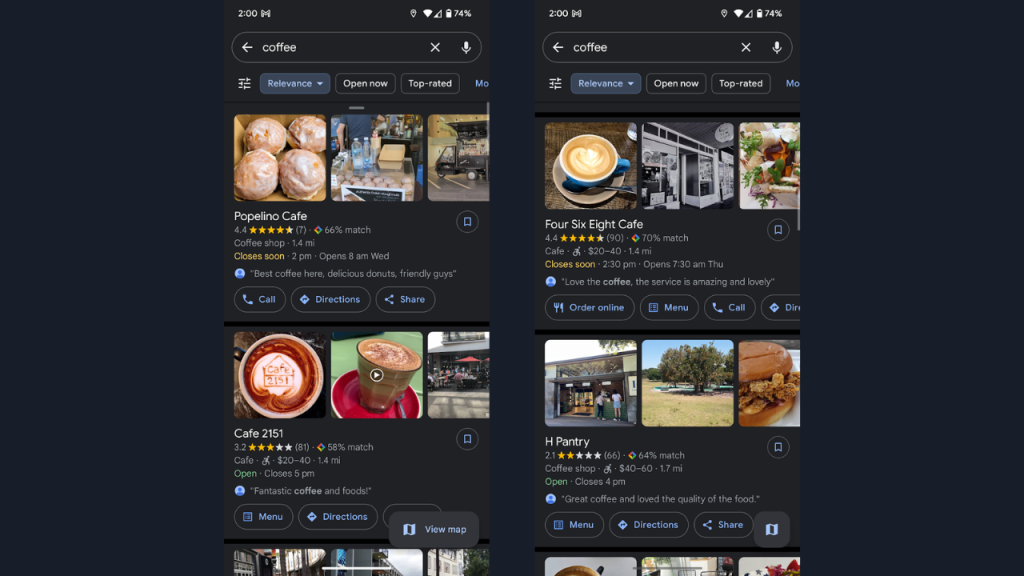
Scope out a coffee place on Google Maps
If you’re in an area that you don’t know about and you’re desperate for a coffee, and would like an idea of how it’s served and the vibe of the place it’s being served in, then all you need to do is type ‘Coffee’ into the Google Maps search bar. You’ll receive user-curated images, videos, and reviews of coffee places around you, along with travel information. This can also be used for restaurants and food, if you’re after a bite.
Happy Google Maps-ing.
Image: Google
This article has been updated since it was originally published.