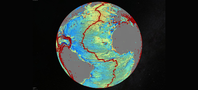
The bottom of the ocean is dark, mysterious, and vast — nearly all of it unmapped. Today, however, scientists reveal the clearest map of the ocean floor ever. They didn’t explore the ocean floor. They didn’t even send instruments into the water. Instead, they used gravity measurements from two satellites orbiting in space.
The map shows thousands of previously unknown underwater mountains, called seamounts, between 900m and 2000m high. It also identified inactive ridges where continents once pulled apart millions of years ago. This detailed look at underwater geology comes from a pair of satellites that were put into space for completely unrelated reasons.
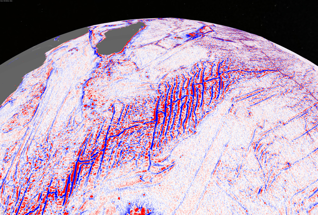
A ridge in the Southwest Indian Ocean as seen by the gravity model.
The two satellites are CryoSat-2, of the European Space Agency, originally designed to monitor the polar ice caps, and Jason-1, of NASA and the French space agency CNES, originally designed to monitor sea levels. In both cases, the satellites are equipped with radar altimeters that measure the distance from the surface of the Earth to the satellite. The thicker the ice or the higher the seas, the smaller that distance.
As the satellites passed over empty oceans, they also gathered reams of data about changes on the ocean surface. The shape of the sea surface is subject to gravity from the huge mountains and canyons below. Subtract out the motion of waves and tides, and you can “see” under the water by just looking at the surface.
The study published today in Science uses a sophisticated new gravity model to construct an underwater map from the sea-surface satellite data. With a maximum resolution of 5km, their map is the sharpest we’ve ever made. But even this massive achievement puts into perspective how vast and unknown the oceans still are. Five kilometer-resolution reveals more than we’ve ever seen, but it’s still a blurry, approximate map. There would be no hope, for example, of locating a missing airliner this way.
For now, we may still know more about the surface of Mars than the bottom of the ocean. [Science via Science News]
Pictures: David Sandwell / Scripps Institute of Oceanography