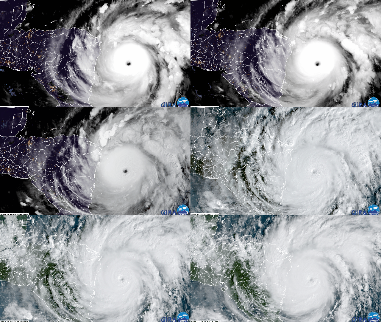
For the second time in two weeks, Central America is facing down a ferocious storm. Hurricane Iota exploded over the weekend and is now a Category 5 monster, setting a record for the latest Category 5 storm on record. To make matters worse, it’s set to make landfall in almost the exact same location in Nicaragua that Category 4 Hurricane Eta hit 13 days ago.
The forecast for Hurricane Iota is as dire as can be. The storm is currently packing winds of 258 km/h, making it the second-strongest November storm to form in 170 years of records. Iota will bring up to 6.1 metres of storm surge and drop up to 762 millimetres of rainfall in areas that were left absolutely battered by Eta, which left at least 50 dead and 2.5 million impacted. Iota may strengthen even further before landfall, though that’s likely to be more of an academic distinction given how catastrophic the storm is.
Hurricane Iota will spend marginally less time stalled over the region than Hurricane Eta and take a different path. But places where the two storms’ paths do overlap will deal with compound effects, particularly related to rainfall. Eta brought even more torrential rain than Iota is forecast to bring, but 13 days is nowhere near enough time for soil to dry out. Iota’s rain will be falling on ground that’s like a sponge that’s been soaking in the sink and can’t hold any more water. That will result in heavy runoff and create a high risk for more flash floods and landslides.
There is simply no precedent for two storms of Category 4 or greater magnitude to make landfall in Nicaragua back-to-back. That both these storms formed in November, when hurricane season is supposed to be winding down, is absolutely mind-boggling. That Iota saw its pressure drop more than 70 millibars in 36 hours is also a record for a November hurricane, putting it in the company of Andrew, Rita, Wilma, and Gilbert — storms that send a chill down any meteorologist’s spine. In a season of unfortunate superlatives, 2020 has saved its most terrifying one for last. If we’re lucky.
The signs of climate change’s influence on hurricanes is growing before our very eyes, and the literature backs it up. Research shows that more rapidly intensifying storms are forming in the Atlantic basin. Hurricanes are also intensifying more quickly and maintaining their strength over land, in yet more symptoms of the climate crisis. Sea level rise is also giving a boost to storm surge, and the warmer atmosphere is giving a boost to rainfall totals since it can hold more water. Seeing storms like Hurricanes Eta and Iota make catastrophic landfall in a region that contributed very little to the cause of global warming but is nevertheless on the frontline is a reminder of the injustice of the crisis and the need to act rapidly and fairly to protect the most vulnerable.
If there’s one saving grace of Iota, it’s that it will traverse Central America rather than recurving into the Caribbean as Eta did. That means the odds of four landfalls are low unless it somehow regains strength in the Pacific and hooks back up toward Mexico. That’s not unheard of, and frankly, I wouldn’t put anything past 2020.
